Neskaupstaður geodata
Neskaupstaður (East) is a populated place; located in Iceland in Atlantic/Reykjavik (GMT+0) time zone. With population of 1,466 people, there are 22 cities with bigger population in this country. Compared to other cities in Iceland, 65.2% of cities are located further ↓South; 100% of cities are located further ←West and 100% of cities have higher elevation than Neskaupstaður. Note1


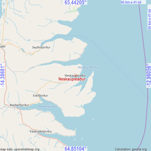
Neskaupstaður GPS coordinates[2]
65° 8' 53.484" North, 13° 41' 1.248" West
| Map corner | latitude | longitude |
|---|---|---|
| Upper-left | 65.44205°, | -14.38681° |
| Center: | 65.14819°, | -13.68368° |
| Lower-right: | 64.85104°, | -12.98056° |
| Map W x H: | 65.7×65.7 km | = 40.8×40.8mi |
| max Lat: | 66.15917° ⇑34.8% North |
| Neskaupstaður: | 65.14819° |
| min Lat: | ⇓65.2% South 63.44273° |
| min Long | Neskaupstaður | max Long |
| -23.99596° | -13.68368° | -13.68368° |
| W 100%⇐ | ⇒0% E |
Elevation
Elevation of Neskaupstaður is 1 m = 3 ft, and this is 20.3 m = 67 ft below average elevation for this country.
| Max E: |
105 m = 344 ft | 100% |
| Avg. | 21.3 m = 70 ft | |
| Neskaupstaður | 1 m = 3 ft | |
Min E: |
1 m = 3 ft | 0% |
See also: Iceland elevation on elevation.city.
Geographical zone
Neskaupstaður is located in North temperate zone (between Tropic of Cancer and the Arctic Circle). Distance of this North polar circle is 157.4 km =97.8 mi to North.| Distance of | km | miles | from Neskaupstaður |
|---|---|---|---|
| North Pole | 2763.3 | 1717 | to North |
| Arctic Circle | 157.4 | 97.8 | to North |
| Tropic Cancer | 4637.9 | 2881.9 | to South |
| Equator | 7243.8 | 4501.1 | to South |


Nearby cities:
9 places around Neskaupstaður: (largest is in red/bold)
• Egilsstaðir
35.7 km =22.2 mi,  291°
291°
• Eskifjörður
17.6 km =10.9 mi,  241°
241°
• Fáskrúðsfjörður
28.8 km =17.9 mi,  213°
213°
• Höfn
123.1 km =76.5 mi,  216°
216°
• Húsavík
195 km =121.2 mi,  300°
300°
• Laugar
182.1 km =113.2 mi, 290°
• Reyðarfjörður
28.2 km =17.5 mi, 242°
• Seyðisfjörður
19.5 km =12.1 mi,  309°
309°
• Vopnafjörður
85.8 km =53.3 mi,  322°
322°
Sources, notices
• [Note1] Compared only with cities in Iceland existing in our database
• [Src1] Map data: © OpenStreetMap contributors (CC-BY-SA)
• [Src2] Other city data from geonames.org with taken over terms of usage.
• [Src3] Geographical zone / Annual Mean Temperature by Robert A. Rohde @ Wikipedia
