Höfn geodata
Höfn (East) is a populated place; located in Iceland in Atlantic/Reykjavik (GMT+0) time zone. With population of 1,690 people, there are 19 cities with bigger population in this country. Compared to other cities in Iceland, 54.3% of cities are located further ↑North; 84.8% of cities are located further ←West and 100% of cities have higher elevation than Höfn. Note1


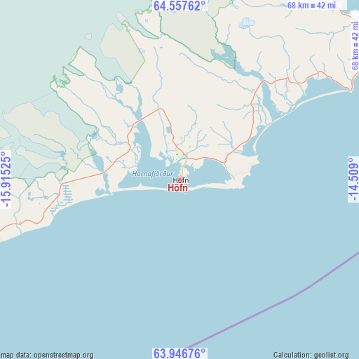
Höfn GPS coordinates[2]
64° 15' 13.968" North, 15° 12' 43.632" West
| Map corner | latitude | longitude |
|---|---|---|
| Upper-left | 64.55762°, | -15.91525° |
| Center: | 64.25388°, | -15.21212° |
| Lower-right: | 63.94676°, | -14.509° |
| Map W x H: | 67.9×67.9 km | = 42.2×42.2mi |
| max Lat: | 66.15917° ⇑54.3% North |
| Höfn: | 64.25388° |
| min Lat: | ⇓45.7% South 63.44273° |
| min Long | Höfn | max Long |
| -23.99596° | -15.21212° | -13.68368° |
| W 84.8%⇐ | ⇒15.2% E |
Elevation
Elevation of Höfn is 1 m = 3 ft, and this is 20.3 m = 67 ft below average elevation for this country.
| Max E: |
105 m = 344 ft | 100% |
| Avg. | 21.3 m = 70 ft | |
| Höfn | 1 m = 3 ft | |
Min E: |
1 m = 3 ft | 0% |
See also: Iceland elevation on elevation.city.
Geographical zone
Höfn is located in North temperate zone (between Tropic of Cancer and the Arctic Circle). Distance of this North polar circle is 256.8 km =159.6 mi to North.| Distance of | km | miles | from Höfn |
|---|---|---|---|
| North Pole | 2862.7 | 1778.8 | to North |
| Arctic Circle | 256.8 | 159.6 | to North |
| Tropic Cancer | 4538.4 | 2820 | to South |
| Equator | 7144.4 | 4439.3 | to South |


Nearby cities:
12 places around Höfn: (largest is in red/bold)
• Akureyri
208.7 km =129.7 mi,  319°
319°
• Dalvík
245.9 km =152.8 mi, 320°
• Egilsstaðir
119.1 km =74 mi,  18°
18°
• Eskifjörður
107.4 km =66.7 mi,  32°
32°
• Fáskrúðsfjörður
94.4 km =58.7 mi,  37°
37°
• Húsavík
222.2 km =138.1 mi,  333°
333°
• Laugar
192.2 km =119.4 mi, 328°
• Neskaupstaður
123.1 km =76.5 mi, 36°
• Reyðarfjörður
98.6 km =61.3 mi, 28°
• Seyðisfjörður
125.6 km =78 mi, 27°
• Vopnafjörður
168.1 km =104.5 mi,  6°
6°
• Ólafsfjörður
257.5 km =160 mi, 321°
Sources, notices
• [Note1] Compared only with cities in Iceland existing in our database
• [Src1] Map data: © OpenStreetMap contributors (CC-BY-SA)
• [Src2] Other city data from geonames.org with taken over terms of usage.
• [Src3] Geographical zone / Annual Mean Temperature by Robert A. Rohde @ Wikipedia
