Vopnafjörður geodata
Vopnafjörður (East) is a populated place; located in Iceland in Atlantic/Reykjavik (GMT+0) time zone. With population of 543 people, there are 42 cities with bigger population in this country. Compared to other cities in Iceland, 84.8% of cities are located further ↓South; 87% of cities are located further ←West and 100% of cities have higher elevation than Vopnafjörður. Note1


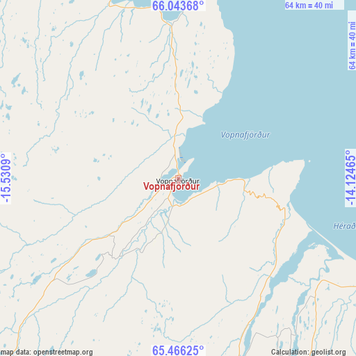
Vopnafjörður GPS coordinates[2]
65° 45' 23.688" North, 14° 49' 39.972" West
| Map corner | latitude | longitude |
|---|---|---|
| Upper-left | 66.04368°, | -15.5309° |
| Center: | 65.75658°, | -14.82777° |
| Lower-right: | 65.46625°, | -14.12465° |
| Map W x H: | 64.2×64.2 km | = 39.9×39.9mi |
| max Lat: | 66.15917° ⇑15.2% North |
| Vopnafjörður: | 65.75658° |
| min Lat: | ⇓84.8% South 63.44273° |
| min Long | Vopnafjörður | max Long |
| -23.99596° | -14.82777° | -13.68368° |
| W 87%⇐ | ⇒13% E |
Elevation
Elevation of Vopnafjörður is 1 m = 3 ft, and this is 20.3 m = 67 ft below average elevation for this country.
| Max E: |
105 m = 344 ft | 100% |
| Avg. | 21.3 m = 70 ft | |
| Vopnafjörður | 1 m = 3 ft | |
Min E: |
1 m = 3 ft | 0% |
See also: Iceland elevation on elevation.city.
Geographical zone
Vopnafjörður is located in North temperate zone (between Tropic of Cancer and the Arctic Circle). Distance of this North polar circle is 89.7 km =55.7 mi to North.| Distance of | km | miles | from Vopnafjörður |
|---|---|---|---|
| North Pole | 2695.6 | 1675 | to North |
| Arctic Circle | 89.7 | 55.7 | to North |
| Tropic Cancer | 4705.5 | 2923.9 | to South |
| Equator | 7311.4 | 4543.1 | to South |


Nearby cities:
12 places around Vopnafjörður: (largest is in red/bold)
• Akureyri
149.3 km =92.8 mi,  266°
266°
• Dalvík
169.9 km =105.6 mi,  278°
278°
• Egilsstaðir
58 km =36 mi,  159°
159°
• Eskifjörður
84.8 km =52.7 mi,  153°
153°
• Fáskrúðsfjörður
99.1 km =61.6 mi, 157°
• Höfn
168.1 km =104.5 mi,  186°
186°
• Húsavík
118.3 km =73.5 mi,  285°
285°
• Laugar
116.4 km =72.3 mi, 268°
• Neskaupstaður
85.8 km =53.3 mi,  142°
142°
• Reyðarfjörður
85.4 km =53.1 mi, 160°
• Seyðisfjörður
67 km =41.6 mi, 145°
• Ólafsfjörður
176.6 km =109.7 mi, 281°
Sources, notices
• [Note1] Compared only with cities in Iceland existing in our database
• [Src1] Map data: © OpenStreetMap contributors (CC-BY-SA)
• [Src2] Other city data from geonames.org with taken over terms of usage.
• [Src3] Geographical zone / Annual Mean Temperature by Robert A. Rohde @ Wikipedia
