Mesoraca geodata
Mesoraca (Calabria) is a seat of a third-order administrative division; located in Italy in Europe/Rome (GMT+2) time zone. With population of 6,158 people, there are 1596 cities with bigger population in this country. Compared to other cities in Italy, 92.3% of cities are located further ↑North; 97.5% of cities are located further ←West and 73.1% of cities have lower elevation than Mesoraca. Note1


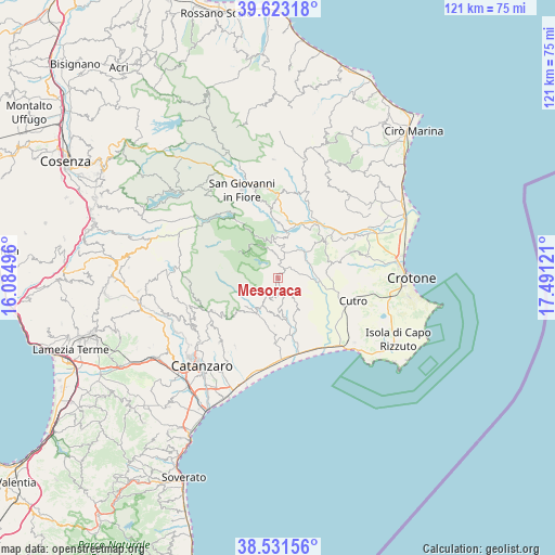
Mesoraca GPS coordinates[2]
39° 4' 46.128" North, 16° 47' 17.088" East
| Map corner | latitude | longitude |
|---|---|---|
| Upper-left | 39.62318°, | 16.08496° |
| Center: | 39.07948°, | 16.78808° |
| Lower-right: | 38.53156°, | 17.49121° |
| Map W x H: | 121.4×121.4 km | = 75.4×75.4mi |
| max Lat: | 47.04031° ⇑92.3% North |
| Mesoraca: | 39.07948° |
| min Lat: | ⇓7.7% South 35.50142° |
| min Long | Mesoraca | max Long |
| 6.69888° | 16.78808° | 18.48682° |
| W 97.5%⇐ | ⇒2.5% E |
Elevation
Elevation of Mesoraca is 427 m = 1401 ft, and this is 120.3 m = 395 ft above average elevation for this country.
| Max E: |
2085 m = 6841 ft | 26.9% |
| Mesoraca | 427 m 1401 ft | |
| Avg. | 306.7 m = 1006 ft | |
Min E: |
-4 m = -13 ft | 73.1% |
See also: Italy elevation on elevation.city.
Geographical zone
Mesoraca is located in North temperate zone (between Tropic of Cancer and the Arctic Circle). Distance of this Northern Tropic circle is 1739.3 km =1080.8 mi to South.| Distance of | km | miles | from Mesoraca |
|---|---|---|---|
| North Pole | 5661.8 | 3518.1 | to North |
| Arctic Circle | 3055.9 | 1898.8 | to North |
| Tropic Cancer | 1739.3 | 1080.8 | to South |
| Equator | 4345.2 | 2700 | to South |


Nearby cities:
15 places around Mesoraca: (largest is in red/bold)
• Andali
7.6 km =4.7 mi,  192°
192°
• Belcastro
6.8 km =4.2 mi,  181°
181°
• Cerva
7.2 km =4.5 mi,  210°
210°
• Cotronei
8.9 km =5.5 mi,  353°
353°
• Cropani
12.5 km =7.8 mi, 183°
• Foresta
3.1 km =1.9 mi,  44°
44°
• Marcedusa
7.2 km =4.5 mi,  144°
144°
• Pagliarelle
7.5 km =4.7 mi,  334°
334°
• Petilia Policastro
3.8 km =2.4 mi, 351°
• Petronà
4.8 km =3 mi, 213°
• Roccabernarda
8.6 km =5.3 mi,  46°
46°
• San Mauro Marchesato
12.2 km =7.6 mi,  76°
76°
• Santa Severina
13 km =8.1 mi, 54°
• Sersale
9.2 km =5.7 mi, 213°
• Zagarise
13.9 km =8.6 mi,  230°
230°
Sources, notices
• [Note1] Compared only with cities in Italy existing in our database
• [Src1] Map data: © OpenStreetMap contributors (CC-BY-SA)
• [Src2] Other city data from geonames.org with taken over terms of usage.
• [Src3] Geographical zone / Annual Mean Temperature by Robert A. Rohde @ Wikipedia
