Bacu Abis geodata
Bacu Abis (Sardinia) is a populated place; located in Italy in Europe/Rome (GMT+2) time zone. With population of 1,673 people, there are 4724 cities with bigger population in this country. Compared to other cities in Italy, 91.7% of cities are located further ↑North; 88.3% of cities are located further →East and 72% of cities have higher elevation than Bacu Abis. Note1


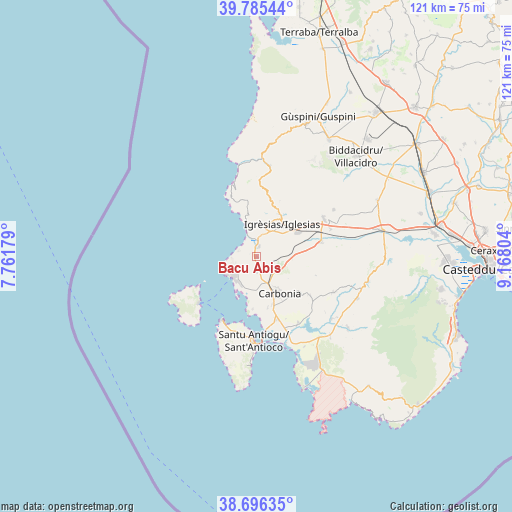
Bacu Abis GPS coordinates[2]
39° 14' 34.836" North, 8° 27' 53.676" East
| Map corner | latitude | longitude |
|---|---|---|
| Upper-left | 39.78544°, | 7.76179° |
| Center: | 39.24301°, | 8.46491° |
| Lower-right: | 38.69635°, | 9.16804° |
| Map W x H: | 121.1×121.1 km | = 75.2×75.2mi |
| max Lat: | 47.04031° ⇑91.7% North |
| Bacu Abis: | 39.24301° |
| min Lat: | ⇓8.3% South 35.50142° |
| min Long | Bacu Abis | max Long |
| 6.69888° | 8.46491° | 18.48682° |
| W 11.7%⇐ | ⇒88.3% E |
Elevation
Elevation of Bacu Abis is 88 m = 289 ft, and this is 218.7 m = 718 ft below average elevation for this country.
| Max E: |
2085 m = 6841 ft | 72% |
| Avg. | 306.7 m = 1006 ft | |
| Bacu Abis | 88 m = 289 ft | |
Min E: |
-4 m = -13 ft | 28% |
See also: Italy elevation on elevation.city.
Geographical zone
Bacu Abis is located in North temperate zone (between Tropic of Cancer and the Arctic Circle). Distance of this Northern Tropic circle is 1757.5 km =1092.1 mi to South.| Distance of | km | miles | from Bacu Abis |
|---|---|---|---|
| North Pole | 5643.6 | 3506.8 | to North |
| Arctic Circle | 3037.8 | 1887.6 | to North |
| Tropic Cancer | 1757.5 | 1092.1 | to South |
| Equator | 4363.4 | 2711.3 | to South |


Nearby cities:
15 places around Bacu Abis: (largest is in red/bold)
• Barbusi
5.8 km =3.6 mi,  140°
140°
• Calasetta
17.3 km =10.7 mi,  208°
208°
• Carbonia
10 km =6.2 mi,  150°
150°
• Cortoghiana
3.5 km =2.2 mi,  179°
179°
• Gonnesa
2.5 km =1.6 mi,  10°
10°
• Iglesias
9.6 km =6 mi,  40°
40°
• Is Urigus
12.3 km =7.6 mi,  167°
167°
• Matzaccara
12.3 km =7.6 mi, 184°
• Nebida
8.2 km =5.1 mi,  343°
343°
• Nuraxi Figus
3.5 km =2.2 mi,  230°
230°
• Paringianu
8.2 km =5.1 mi,  201°
201°
• Perdaxius
15.6 km =9.7 mi,  126°
126°
• Portoscuso
8.3 km =5.2 mi,  241°
241°
• San Giovanni Suergiu
15.6 km =9.7 mi,  162°
162°
• Villamassargia
15.6 km =9.7 mi,  76°
76°
Sources, notices
• [Note1] Compared only with cities in Italy existing in our database
• [Src1] Map data: © OpenStreetMap contributors (CC-BY-SA)
• [Src2] Other city data from geonames.org with taken over terms of usage.
• [Src3] Geographical zone / Annual Mean Temperature by Robert A. Rohde @ Wikipedia
