Compiano geodata
Compiano (Emilia-Romagna) is a seat of a third-order administrative division; located in Italy in Europe/Rome (GMT+2) time zone. With population of 125 people, there are 11366 cities with bigger population in this country. Compared to other cities in Italy, 51% of cities are located further ↓South; 71.2% of cities are located further →East and 79.5% of cities have lower elevation than Compiano. Note1


Compiano GPS coordinates[2]
44° 29' 45.78" North, 9° 39' 43.452" East
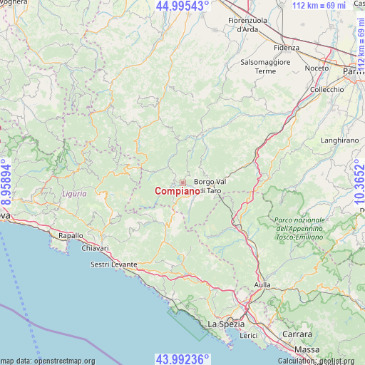
| Map corner | latitude | longitude |
|---|---|---|
| Upper-left | 44.99543°, | 8.95894° |
| Center: | 44.49605°, | 9.66207° |
| Lower-right: | 43.99236°, | 10.3652° |
| Map W x H: | 111.5×111.5 km | = 69.3×69.3mi |
| max Lat: | 47.04031° ⇑49% North |
| Compiano: | 44.49605° |
| min Lat: | ⇓51% South 35.50142° |
| min Long | Compiano | max Long |
| 6.69888° | 9.66207° | 18.48682° |
| W 28.8%⇐ | ⇒71.2% E |
Elevation
Elevation of Compiano is 519 m = 1703 ft, and this is 212.3 m = 697 ft above average elevation for this country.
| Max E: |
2085 m = 6841 ft | 20.5% |
| Compiano | 519 m 1703 ft | |
| Avg. | 306.7 m = 1006 ft | |
Min E: |
-4 m = -13 ft | 79.5% |
See also: Italy elevation on elevation.city.
Geographical zone
Compiano is located in North temperate zone (between Tropic of Cancer and the Arctic Circle). Distance of this Northern Tropic circle is 2341.6 km =1455 mi to South.| Distance of | km | miles | from Compiano |
|---|---|---|---|
| North Pole | 5059.6 | 3143.9 | to North |
| Arctic Circle | 2453.7 | 1524.7 | to North |
| Tropic Cancer | 2341.6 | 1455 | to South |
| Equator | 4947.5 | 3074.2 | to South |


Nearby cities:
15 places around Compiano: (largest is in red/bold)
• Albareto
6.3 km =3.9 mi,  149°
149°
• Bardi
16 km =9.9 mi,  19°
19°
• Bedonia
2.3 km =1.4 mi,  292°
292°
• Borgo Val di Taro
8.5 km =5.3 mi,  95°
95°
• Borzonasca
23.3 km =14.5 mi,  248°
248°
• Ferriere
21 km =13 mi,  321°
321°
• Maissana
20.4 km =12.7 mi,  209°
209°
• Patigno
17.8 km =11.1 mi, 153°
• Pontremoli
21.8 km =13.5 mi,  127°
127°
• Rezzoaglio
22 km =13.7 mi,  278°
278°
• Santo Stefano d'Aveto
17.5 km =10.9 mi, 288°
• Sesta Godano
22.5 km =14 mi,  177°
177°
• Tornolo
3 km =1.9 mi, 246°
• Varese Ligure
14.3 km =8.9 mi,  202°
202°
• Zeri
17.7 km =11 mi, 153°
Sources, notices
• [Note1] Compared only with cities in Italy existing in our database
• [Src1] Map data: © OpenStreetMap contributors (CC-BY-SA)
• [Src2] Other city data from geonames.org with taken over terms of usage.
• [Src3] Geographical zone / Annual Mean Temperature by Robert A. Rohde @ Wikipedia
