Troia geodata
Troia (Apulia) is a seat of a third-order administrative division; located in Italy in Europe/Rome (GMT+2) time zone. With population of 6,614 people, there are 1480 cities with bigger population in this country. Compared to other cities in Italy, 75.7% of cities are located further ↑North; 89.7% of cities are located further ←West and 69% of cities have lower elevation than Troia. Note1


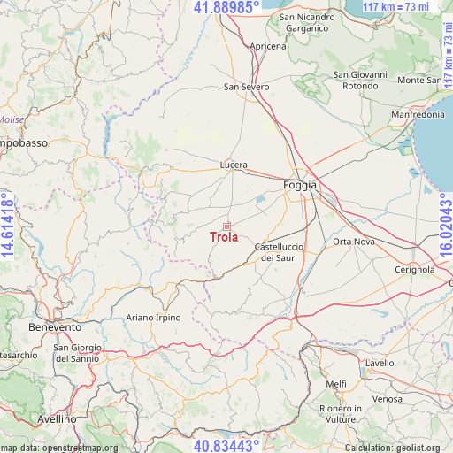
Troia GPS coordinates[2]
41° 21' 51.408" North, 15° 19' 2.28" East
| Map corner | latitude | longitude |
|---|---|---|
| Upper-left | 41.88985°, | 14.61418° |
| Center: | 41.36428°, | 15.3173° |
| Lower-right: | 40.83443°, | 16.02043° |
| Map W x H: | 117.4×117.4 km | = 72.9×72.9mi |
| max Lat: | 47.04031° ⇑75.7% North |
| Troia: | 41.36428° |
| min Lat: | ⇓24.3% South 35.50142° |
| min Long | Troia | max Long |
| 6.69888° | 15.3173° | 18.48682° |
| W 89.7%⇐ | ⇒10.3% E |
Elevation
Elevation of Troia is 384 m = 1260 ft, and this is 77.3 m = 254 ft above average elevation for this country.
| Max E: |
2085 m = 6841 ft | 31% |
| Troia | 384 m 1260 ft | |
| Avg. | 306.7 m = 1006 ft | |
Min E: |
-4 m = -13 ft | 69% |
See also: Italy elevation on elevation.city.
Geographical zone
Troia is located in North temperate zone (between Tropic of Cancer and the Arctic Circle). Distance of this Northern Tropic circle is 1993.4 km =1238.6 mi to South.| Distance of | km | miles | from Troia |
|---|---|---|---|
| North Pole | 5407.8 | 3360.3 | to North |
| Arctic Circle | 2801.9 | 1741 | to North |
| Tropic Cancer | 1993.4 | 1238.6 | to South |
| Equator | 4599.3 | 2857.9 | to South |


Nearby cities:
15 places around Troia: (largest is in red/bold)
• Alberona
17.9 km =11.1 mi,  295°
295°
• Biccari
10.7 km =6.6 mi,  290°
290°
• Bovino
12.9 km =8 mi,  171°
171°
• Castelluccio Valmaggiore
10.1 km =6.3 mi,  256°
256°
• Castelluccio dei Sauri
14.8 km =9.2 mi,  116°
116°
• Celle di San Vito
12.1 km =7.5 mi,  249°
249°
• Deliceto
16.7 km =10.4 mi,  160°
160°
• Faeto
13.8 km =8.6 mi, 251°
• Greci
17.6 km =10.9 mi,  224°
224°
• Lucera
15.8 km =9.8 mi,  6°
6°
• Montaguto
14.1 km =8.8 mi,  204°
204°
• Orsara di Puglia
10.1 km =6.3 mi, 204°
• Panni
16.3 km =10.1 mi,  192°
192°
• Roseto Valfortore
18.3 km =11.4 mi,  273°
273°
• Savignano Irpino
19.1 km =11.9 mi, 217°
Sources, notices
• [Note1] Compared only with cities in Italy existing in our database
• [Src1] Map data: © OpenStreetMap contributors (CC-BY-SA)
• [Src2] Other city data from geonames.org with taken over terms of usage.
• [Src3] Geographical zone / Annual Mean Temperature by Robert A. Rohde @ Wikipedia
