Serravalle di Chienti geodata
Serravalle di Chienti (The Marches) is a seat of a third-order administrative division; located in Italy in Europe/Rome (GMT+2) time zone. With population of 457 people, there are 10063 cities with bigger population in this country. Compared to other cities in Italy, 62.8% of cities are located further ↑North; 67.7% of cities are located further ←West and 86.7% of cities have lower elevation than Serravalle di Chienti. Note1
Administrative division(s):
- Level 1: The Marches
- Level 2: Provincia di Macerata
- Level 3: Serravalle di Chienti
Current local time in Serravalle di Chienti:
09:01 PM, WednesdayDifference from your time zone: hours


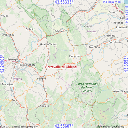
Serravalle di Chienti GPS coordinates[2]
43° 4' 18.66" North, 12° 57' 7.812" East
| Map corner | latitude | longitude |
|---|---|---|
| Upper-left | 43.58333°, | 12.24905° |
| Center: | 43.07185°, | 12.95217° |
| Lower-right: | 42.55607°, | 13.6553° |
| Map W x H: | 114.2×114.2 km | = 71×71mi |
| max Lat: | 47.04031° ⇑62.8% North |
| Serravalle di Chienti: | 43.07185° |
| min Lat: | ⇓37.2% South 35.50142° |
| min Long | Serravalle di C | max Long |
| 6.69888° | 12.95217° | 18.48682° |
| W 67.7%⇐ | ⇒32.3% E |
Elevation
Elevation of Serravalle di Chienti is 645 m = 2116 ft, and this is 338.3 m = 1110 ft above average elevation for this country.
| Max E: |
2085 m = 6841 ft | 13.3% |
| Serravalle di Chienti | 645 m 2116 ft | |
| Avg. | 306.7 m = 1006 ft | |
Min E: |
-4 m = -13 ft | 86.7% |
See also: Italy elevation on elevation.city.
Geographical zone
Serravalle di Chienti is located in North temperate zone (between Tropic of Cancer and the Arctic Circle). Distance of this Northern Tropic circle is 2183.2 km =1356.6 mi to South.| Distance of | km | miles | from Serravalle di Chienti |
|---|---|---|---|
| North Pole | 5217.9 | 3242.3 | to North |
| Arctic Circle | 2612 | 1623 | to North |
| Tropic Cancer | 2183.2 | 1356.6 | to South |
| Equator | 4789.1 | 2975.8 | to South |


Nearby cities:
15 places around Serravalle di Chienti: (largest is in red/bold)
• Camerino
12 km =7.5 mi,  51°
51°
• Castelraimondo
17.3 km =10.7 mi,  28°
28°
• Massa
13 km =8.1 mi,  352°
352°
• Muccia
7.5 km =4.7 mi,  81°
81°
• Nocera Umbra
14 km =8.7 mi,  289°
289°
• Pie' del Colle
18.7 km =11.6 mi,  104°
104°
• Pie' del Sasso
9.4 km =5.8 mi,  156°
156°
• Pieve Torina
8.4 km =5.2 mi,  112°
112°
• Pievebovigliana
10.7 km =6.6 mi, 95°
• Pioraco
12.3 km =7.6 mi,  9°
9°
• Sefro
8.4 km =5.2 mi,  358°
358°
• Trebbio
16.8 km =10.4 mi, 103°
• Valle e Castello
11.6 km =7.2 mi, 109°
• Valtopina
16.3 km =10.1 mi,  264°
264°
• Visso
18.6 km =11.6 mi,  145°
145°
Sources, notices
• [Note1] Compared only with cities in Italy existing in our database
• [Src1] Map data: © OpenStreetMap contributors (CC-BY-SA)
• [Src2] Other city data from geonames.org with taken over terms of usage.
• [Src3] Geographical zone / Annual Mean Temperature by Robert A. Rohde @ Wikipedia
