Massa geodata
Massa (The Marches) is a seat of a third-order administrative division; located in Italy in Europe/Rome (GMT+2) time zone. With population of 681 people, there are 8427 cities with bigger population in this country. Compared to other cities in Italy, 61.9% of cities are located further ↑North; 67.5% of cities are located further ←West and 75.9% of cities have lower elevation than Massa. Note1


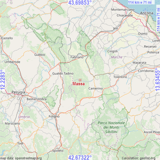
Massa GPS coordinates[2]
43° 11' 16.908" North, 12° 55' 53.112" East
| Map corner | latitude | longitude |
|---|---|---|
| Upper-left | 43.69853°, | 12.2283° |
| Center: | 43.18803°, | 12.93142° |
| Lower-right: | 42.67322°, | 13.63455° |
| Map W x H: | 114×114 km | = 70.8×70.8mi |
| max Lat: | 47.04031° ⇑61.9% North |
| Massa: | 43.18803° |
| min Lat: | ⇓38.1% South 35.50142° |
| min Long | Massa | max Long |
| 6.69888° | 12.93142° | 18.48682° |
| W 67.5%⇐ | ⇒32.5% E |
Elevation
Elevation of Massa is 464 m = 1522 ft, and this is 157.3 m = 516 ft above average elevation for this country.
| Max E: |
2085 m = 6841 ft | 24.1% |
| Massa | 464 m 1522 ft | |
| Avg. | 306.7 m = 1006 ft | |
Min E: |
-4 m = -13 ft | 75.9% |
See also: Italy elevation on elevation.city.
Geographical zone
Massa is located in North temperate zone (between Tropic of Cancer and the Arctic Circle). Distance of this Northern Tropic circle is 2196.1 km =1364.6 mi to South.| Distance of | km | miles | from Massa |
|---|---|---|---|
| North Pole | 5205 | 3234.2 | to North |
| Arctic Circle | 2599.1 | 1615 | to North |
| Tropic Cancer | 2196.1 | 1364.6 | to South |
| Equator | 4802.1 | 2983.9 | to South |


Nearby cities:
15 places around Massa: (largest is in red/bold)
• Camerino
12.4 km =7.7 mi,  116°
116°
• Castelraimondo
10.3 km =6.4 mi,  77°
77°
• Cerqueto
15.6 km =9.7 mi,  288°
288°
• Cerreto d'Esi
15 km =9.3 mi,  17°
17°
• Esanatoglia
7.3 km =4.5 mi,  11°
11°
• Fabriano
17 km =10.6 mi,  352°
352°
• Gagliole
12.4 km =7.7 mi,  63°
63°
• Gualdo Tadino
13.2 km =8.2 mi, 290°
• Matelica
9.9 km =6.2 mi,  38°
38°
• Muccia
14.8 km =9.2 mi,  142°
142°
• Nocera Umbra
14.2 km =8.8 mi,  234°
234°
• Palazzo Mancinelli-Vaccara
15.8 km =9.8 mi,  300°
300°
• Pioraco
3.8 km =2.4 mi,  102°
102°
• Sefro
4.7 km =2.9 mi,  162°
162°
• Serravalle di Chienti
13 km =8.1 mi,  172°
172°
Sources, notices
• [Note1] Compared only with cities in Italy existing in our database
• [Src1] Map data: © OpenStreetMap contributors (CC-BY-SA)
• [Src2] Other city data from geonames.org with taken over terms of usage.
• [Src3] Geographical zone / Annual Mean Temperature by Robert A. Rohde @ Wikipedia
