San Giovanni e Paolo geodata
San Giovanni e Paolo (Campania) is a populated place; located in Italy in Europe/Rome (GMT+2) time zone. With population of 510 people, there are 9825 cities with bigger population in this country. Compared to other cities in Italy, 77.1% of cities are located further ↑North; 81.7% of cities are located further ←West and 54.6% of cities have lower elevation than San Giovanni e Paolo. Note1
Current local time in San Giovanni e Paolo:
07:02 PM, WednesdayDifference from your time zone: hours


San Giovanni e Paolo GPS coordinates[2]
41° 10' 33.024" North, 14° 23' 16.224" East
| Map corner | latitude | longitude |
|---|---|---|
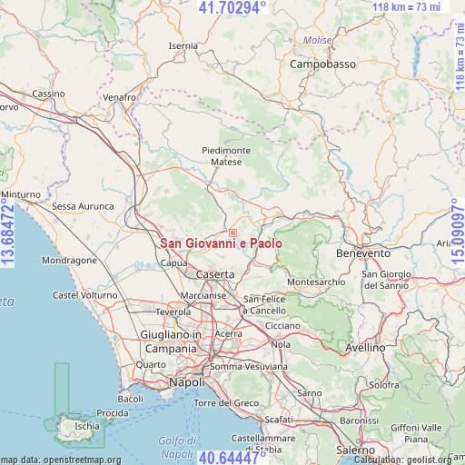
| Upper-left | 41.70294°, | 13.68472° |
| Center: | 41.17584°, | 14.38784° |
| Lower-right: | 40.64447°, | 15.09097° |
| Map W x H: | 117.7×117.7 km | = 73.1×73.1mi |
| max Lat: | 47.04031° ⇑77.1% North |
| San Giovanni e Paolo: | 41.17584° |
| min Lat: | ⇓22.9% South 35.50142° |
| min Long | San Giovanni e | max Long |
| 6.69888° | 14.38784° | 18.48682° |
| W 81.7%⇐ | ⇒18.3% E |
Elevation
Elevation of San Giovanni e Paolo is 263 m = 863 ft, and this is 43.7 m = 143 ft below average elevation for this country.
| Max E: |
2085 m = 6841 ft | 45.4% |
| Avg. | 306.7 m = 1006 ft | |
| San Giovanni e Paolo | 263 m = 863 ft | |
Min E: |
-4 m = -13 ft | 54.6% |
See also: Italy elevation on elevation.city.
Geographical zone
San Giovanni e Paolo is located in North temperate zone (between Tropic of Cancer and the Arctic Circle). Distance of this Northern Tropic circle is 1972.4 km =1225.6 mi to South.| Distance of | km | miles | from San Giovanni e Paolo |
|---|---|---|---|
| North Pole | 5428.7 | 3373.2 | to North |
| Arctic Circle | 2822.8 | 1754 | to North |
| Tropic Cancer | 1972.4 | 1225.6 | to South |
| Equator | 4578.3 | 2844.8 | to South |


Nearby cities:
15 places around San Giovanni e Paolo: (largest is in red/bold)
• Alvignano
8.7 km =5.4 mi,  330°
330°
• Amorosi
7.2 km =4.5 mi,  65°
65°
• Annunziata
6.4 km =4 mi,  197°
197°
• Caiazzo
2.6 km =1.6 mi,  291°
291°
• Casola
9 km =5.6 mi,  183°
183°
• Castel Campagnano
5.5 km =3.4 mi,  82°
82°
• Castel Morrone
6.7 km =4.2 mi, 204°
• Castel di Sasso
9.4 km =5.8 mi,  281°
281°
• Dugenta
7.2 km =4.5 mi,  129°
129°
• Giardoni
7.2 km =4.5 mi,  151°
151°
• Liberi
9.9 km =6.2 mi,  304°
304°
• Limatola
4 km =2.5 mi,  172°
172°
• Piana di Monte Verna
4.6 km =2.9 mi,  257°
257°
• Puglianello
7.3 km =4.5 mi,  45°
45°
• Ruviano
4.3 km =2.7 mi,  25°
25°
Sources, notices
• [Note1] Compared only with cities in Italy existing in our database
• [Src1] Map data: © OpenStreetMap contributors (CC-BY-SA)
• [Src2] Other city data from geonames.org with taken over terms of usage.
• [Src3] Geographical zone / Annual Mean Temperature by Robert A. Rohde @ Wikipedia
