Limatola geodata
Limatola (Campania) is a seat of a third-order administrative division; located in Italy in Europe/Rome (GMT+2) time zone. With population of 2,668 people, there are 3344 cities with bigger population in this country. Compared to other cities in Italy, 77.3% of cities are located further ↑North; 81.8% of cities are located further ←West and 80.1% of cities have higher elevation than Limatola. Note1


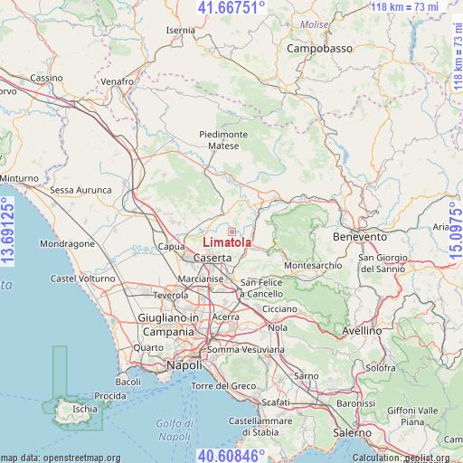
Limatola GPS coordinates[2]
41° 8' 24.432" North, 14° 23' 39.732" East
| Map corner | latitude | longitude |
|---|---|---|
| Upper-left | 41.66751°, | 13.69125° |
| Center: | 41.14012°, | 14.39437° |
| Lower-right: | 40.60846°, | 15.0975° |
| Map W x H: | 117.8×117.8 km | = 73.2×73.2mi |
| max Lat: | 47.04031° ⇑77.3% North |
| Limatola: | 41.14012° |
| min Lat: | ⇓22.7% South 35.50142° |
| min Long | Limatola | max Long |
| 6.69888° | 14.39437° | 18.48682° |
| W 81.8%⇐ | ⇒18.2% E |
Elevation
Elevation of Limatola is 49 m = 161 ft, and this is 257.7 m = 845 ft below average elevation for this country.
| Max E: |
2085 m = 6841 ft | 80.1% |
| Avg. | 306.7 m = 1006 ft | |
| Limatola | 49 m = 161 ft | |
Min E: |
-4 m = -13 ft | 19.9% |
See also: Italy elevation on elevation.city.
Geographical zone
Limatola is located in North temperate zone (between Tropic of Cancer and the Arctic Circle). Distance of this Northern Tropic circle is 1968.4 km =1223.1 mi to South.| Distance of | km | miles | from Limatola |
|---|---|---|---|
| North Pole | 5432.7 | 3375.7 | to North |
| Arctic Circle | 2826.8 | 1756.5 | to North |
| Tropic Cancer | 1968.4 | 1223.1 | to South |
| Equator | 4574.4 | 2842.4 | to South |


Nearby cities:
15 places around Limatola: (largest is in red/bold)
• Amorosi
9.2 km =5.7 mi,  40°
40°
• Annunziata
3.2 km =2 mi,  228°
228°
• Bagnoli
7.4 km =4.6 mi,  148°
148°
• Caiazzo
5.7 km =3.5 mi,  329°
329°
• Caserta
9.1 km =5.7 mi,  214°
214°
• Casola
5.1 km =3.2 mi,  191°
191°
• Castel Campagnano
6.8 km =4.2 mi,  46°
46°
• Castel Morrone
3.9 km =2.4 mi,  237°
237°
• Dugenta
5 km =3.1 mi,  96°
96°
• Giardoni
3.8 km =2.4 mi,  128°
128°
• Melizzano
9.6 km =6 mi,  75°
75°
• Piana di Monte Verna
5.9 km =3.7 mi,  300°
300°
• Ruviano
7.9 km =4.9 mi,  9°
9°
• San Giovanni e Paolo
4 km =2.5 mi,  352°
352°
• Valle di Maddaloni
7 km =4.3 mi,  163°
163°
Sources, notices
• [Note1] Compared only with cities in Italy existing in our database
• [Src1] Map data: © OpenStreetMap contributors (CC-BY-SA)
• [Src2] Other city data from geonames.org with taken over terms of usage.
• [Src3] Geographical zone / Annual Mean Temperature by Robert A. Rohde @ Wikipedia
