San Benedetto Po geodata
San Benedetto Po (Lombardy) is a seat of a third-order administrative division; located in Italy in Europe/Rome (GMT+2) time zone. With population of 5,312 people, there are 1838 cities with bigger population in this country. Compared to other cities in Italy, 61.1% of cities are located further ↓South; 58.1% of cities are located further →East and 91.1% of cities have higher elevation than San Benedetto Po. Note1
Administrative division(s):
- Level 1: Lombardy
- Level 2: Provincia di Mantova
- Level 3: San Benedetto Po


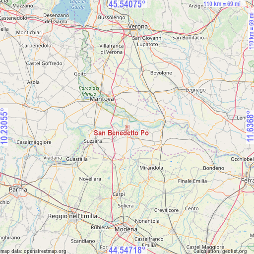
San Benedetto Po GPS coordinates[2]
45° 2' 46.032" North, 10° 56' 1.212" East
| Map corner | latitude | longitude |
|---|---|---|
| Upper-left | 45.54075°, | 10.23055° |
| Center: | 45.04612°, | 10.93367° |
| Lower-right: | 44.54718°, | 11.6368° |
| Map W x H: | 110.5×110.5 km | = 68.7×68.7mi |
| max Lat: | 47.04031° ⇑38.9% North |
| San Benedetto Po: | 45.04612° |
| min Lat: | ⇓61.1% South 35.50142° |
| min Long | San Benedetto P | max Long |
| 6.69888° | 10.93367° | 18.48682° |
| W 41.9%⇐ | ⇒58.1% E |
Elevation
Elevation of San Benedetto Po is 16 m = 52 ft, and this is 290.7 m = 954 ft below average elevation for this country.
| Max E: |
2085 m = 6841 ft | 91.1% |
| Avg. | 306.7 m = 1006 ft | |
| San Benedetto Po | 16 m = 52 ft | |
Min E: |
-4 m = -13 ft | 8.9% |
See also: Italy elevation on elevation.city.
Geographical zone
San Benedetto Po is located in North temperate zone (between Tropic of Cancer and the Arctic Circle). Distance of this North polar circle is 2392.5 km =1486.6 mi to North.| Distance of | km | miles | from San Benedetto Po |
|---|---|---|---|
| North Pole | 4998.4 | 3105.9 | to North |
| Arctic Circle | 2392.5 | 1486.6 | to North |
| Tropic Cancer | 2402.7 | 1493 | to South |
| Equator | 5008.7 | 3112.3 | to South |


Nearby cities:
15 places around San Benedetto Po: (largest is in red/bold)
• Bagnolo San Vito
6.5 km =4 mi,  317°
317°
• Barbasso
8.5 km =5.3 mi,  345°
345°
• Bondanello
9.7 km =6 mi,  174°
174°
• Formigosa
10.3 km =6.4 mi,  328°
328°
• Libiola
10.1 km =6.3 mi,  79°
79°
• Pegognaga
8.2 km =5.1 mi,  225°
225°
• Pietole
11.8 km =7.3 mi,  309°
309°
• Quingentole
8.9 km =5.5 mi,  95°
95°
• Quistello
5.8 km =3.6 mi,  137°
137°
• Roncoferraro
10.3 km =6.4 mi,  3°
3°
• San Biagio
9 km =5.6 mi, 311°
• San Giacomo delle Segnate
11.3 km =7 mi, 135°
• Serravalle a Po
11.9 km =7.4 mi, 79°
• Sustinente
7.5 km =4.7 mi,  68°
68°
• Villa Saviola
10.7 km =6.6 mi,  260°
260°
Sources, notices
• [Note1] Compared only with cities in Italy existing in our database
• [Src1] Map data: © OpenStreetMap contributors (CC-BY-SA)
• [Src2] Other city data from geonames.org with taken over terms of usage.
• [Src3] Geographical zone / Annual Mean Temperature by Robert A. Rohde @ Wikipedia
