Saint-Oyen geodata
Saint-Oyen (Aosta Valley) is a seat of a third-order administrative division; located in Italy in Europe/Rome (GMT+2) time zone. With population of 217 people, there are 11048 cities with bigger population in this country. Compared to other cities in Italy, 86.9% of cities are located further ↓South; 99.3% of cities are located further →East and 99.4% of cities have lower elevation than Saint-Oyen. Note1


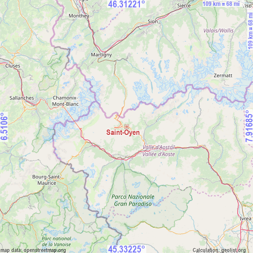
Saint-Oyen GPS coordinates[2]
45° 49' 27.804" North, 7° 12' 49.392" East
| Map corner | latitude | longitude |
|---|---|---|
| Upper-left | 46.31221°, | 6.5106° |
| Center: | 45.82439°, | 7.21372° |
| Lower-right: | 45.33225°, | 7.91685° |
| Map W x H: | 109×109 km | = 67.7×67.7mi |
| max Lat: | 47.04031° ⇑13.1% North |
| Saint-Oyen: | 45.82439° |
| min Lat: | ⇓86.9% South 35.50142° |
| min Long | Saint-Oyen | max Long |
| 6.69888° | 7.21372° | 18.48682° |
| W 0.7%⇐ | ⇒99.3% E |
Elevation
Elevation of Saint-Oyen is 1366 m = 4482 ft, and this is 1059.3 m = 3475 ft above average elevation for this country.
| Max E: |
2085 m = 6841 ft | 0.59999999999999% |
| Saint-Oyen | 1366 m 4482 ft | |
| Avg. | 306.7 m = 1006 ft | |
Min E: |
-4 m = -13 ft | 99.4% |
See also: Italy elevation on elevation.city.
Geographical zone
Saint-Oyen is located in North temperate zone (between Tropic of Cancer and the Arctic Circle). Distance of this North polar circle is 2306 km =1432.9 mi to North.| Distance of | km | miles | from Saint-Oyen |
|---|---|---|---|
| North Pole | 4911.9 | 3052.1 | to North |
| Arctic Circle | 2306 | 1432.9 | to North |
| Tropic Cancer | 2489.3 | 1546.8 | to South |
| Equator | 5095.2 | 3166 | to South |


Nearby cities:
15 places around Saint-Oyen: (largest is in red/bold)
• Allein
4.9 km =3 mi,  112°
112°
• Arpuilles
10.6 km =6.6 mi,  137°
137°
• Doues
7.2 km =4.5 mi,  94°
94°
• Etroubles
1.4 km =0.9 mi, 106°
• Gignod
8.1 km =5 mi,  127°
127°
• La Cretaz-Roisan
8.9 km =5.5 mi,  120°
120°
• Montan-Angelin-Arensod
11.8 km =7.3 mi,  155°
155°
• Ollomont
8 km =5 mi,  69°
69°
• Porossan
11.6 km =7.2 mi, 130°
• Saint Maurice
12.3 km =7.6 mi, 164°
• Saint-Rhémy
2.6 km =1.6 mi,  298°
298°
• San Leonardo
2.5 km =1.6 mi,  268°
268°
• Valpelline
8.7 km =5.4 mi, 89°
• Variney Chez Roncoz
9.7 km =6 mi, 129°
• Ville Sur Sarre
10.7 km =6.6 mi, 161°
Sources, notices
• [Note1] Compared only with cities in Italy existing in our database
• [Src1] Map data: © OpenStreetMap contributors (CC-BY-SA)
• [Src2] Other city data from geonames.org with taken over terms of usage.
• [Src3] Geographical zone / Annual Mean Temperature by Robert A. Rohde @ Wikipedia
