La Cretaz-Roisan geodata
La Cretaz-Roisan (Aosta Valley) is a seat of a third-order administrative division; located in Italy in Europe/Rome (GMT+2) time zone. With population of 731 people, there are 8076 cities with bigger population in this country. Compared to other cities in Italy, 85.1% of cities are located further ↓South; 98.9% of cities are located further →East and 95% of cities have lower elevation than La Cretaz-Roisan. Note1


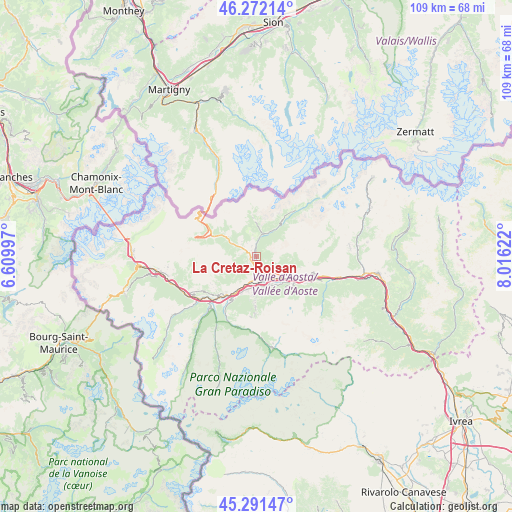
La Cretaz-Roisan GPS coordinates[2]
45° 47' 2.256" North, 7° 18' 47.16" East
| Map corner | latitude | longitude |
|---|---|---|
| Upper-left | 46.27214°, | 6.60997° |
| Center: | 45.78396°, | 7.3131° |
| Lower-right: | 45.29147°, | 8.01622° |
| Map W x H: | 109×109 km | = 67.7×67.7mi |
| max Lat: | 47.04031° ⇑14.9% North |
| La Cretaz-Roisan: | 45.78396° |
| min Lat: | ⇓85.1% South 35.50142° |
| min Long | La Cretaz-Roisa | max Long |
| 6.69888° | 7.3131° | 18.48682° |
| W 1.1%⇐ | ⇒98.9% E |
Elevation
Elevation of La Cretaz-Roisan is 873 m = 2864 ft, and this is 566.3 m = 1858 ft above average elevation for this country.
| Max E: |
2085 m = 6841 ft | 5% |
| La Cretaz-Roisan | 873 m 2864 ft | |
| Avg. | 306.7 m = 1006 ft | |
Min E: |
-4 m = -13 ft | 95% |
See also: Italy elevation on elevation.city.
Geographical zone
La Cretaz-Roisan is located in North temperate zone (between Tropic of Cancer and the Arctic Circle). Distance of this North polar circle is 2310.5 km =1435.7 mi to North.| Distance of | km | miles | from La Cretaz-Roisan |
|---|---|---|---|
| North Pole | 4916.4 | 3054.9 | to North |
| Arctic Circle | 2310.5 | 1435.7 | to North |
| Tropic Cancer | 2484.8 | 1544 | to South |
| Equator | 5090.7 | 3163.2 | to South |


Nearby cities:
15 places around La Cretaz-Roisan: (largest is in red/bold)
• Allein
4.1 km =2.5 mi,  309°
309°
• Aosta
5.2 km =3.2 mi,  176°
176°
• Arpuilles
3.3 km =2.1 mi,  189°
189°
• Chef-Lieu
4.8 km =3 mi,  139°
139°
• Doues
4 km =2.5 mi,  351°
351°
• Gignod
1.4 km =0.9 mi,  251°
251°
• Montan-Angelin-Arensod
6.8 km =4.2 mi,  204°
204°
• Plan Felinaz-Felinaz
6.5 km =4 mi,  165°
165°
• Pollein
6.9 km =4.3 mi,  154°
154°
• Pont Suaz-Ampaillant
6.4 km =4 mi, 176°
• Porossan
3.3 km =2.1 mi,  160°
160°
• Saint-Christophe
4.2 km =2.6 mi, 141°
• Valpelline
4.6 km =2.9 mi,  11°
11°
• Variney Chez Roncoz
1.7 km =1.1 mi, 186°
• Ville Sur Sarre
7 km =4.3 mi,  216°
216°
Sources, notices
• [Note1] Compared only with cities in Italy existing in our database
• [Src1] Map data: © OpenStreetMap contributors (CC-BY-SA)
• [Src2] Other city data from geonames.org with taken over terms of usage.
• [Src3] Geographical zone / Annual Mean Temperature by Robert A. Rohde @ Wikipedia
