Prato Allo Stelvio geodata
Prato Allo Stelvio (Trentino-Alto Adige) is a seat of a third-order administrative division; located in Italy in Europe/Rome (GMT+2) time zone. With population of 2,640 people, there are 3380 cities with bigger population in this country. Compared to other cities in Italy, 99% of cities are located further ↓South; 61.9% of cities are located further →East and 95.6% of cities have lower elevation than Prato Allo Stelvio. Note1
Administrative division(s):
- Level 1: Trentino-Alto Adige
- Level 2: Bolzano
- Level 3: Prato allo Stelvio - Prad am Stilfser Joch


Prato Allo Stelvio GPS coordinates[2]
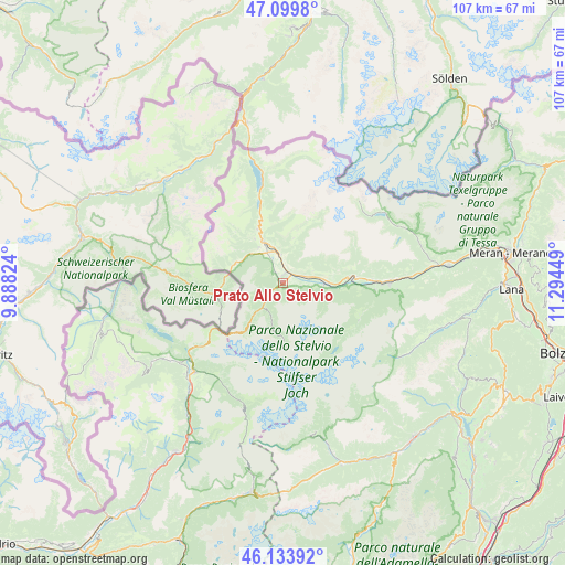
46° 37' 8.436" North, 10° 35' 28.896" East
| Map corner | latitude | longitude |
|---|---|---|
| Upper-left | 47.0998°, | 9.88824° |
| Center: | 46.61901°, | 10.59136° |
| Lower-right: | 46.13392°, | 11.29449° |
| Map W x H: | 107.4×107.4 km | = 66.7×66.7mi |
| max Lat: | 47.04031° ⇑1% North |
| Prato Allo Stelvio: | 46.61901° |
| min Lat: | ⇓99% South 35.50142° |
| min Long | Prato Allo Stel | max Long |
| 6.69888° | 10.59136° | 18.48682° |
| W 38.1%⇐ | ⇒61.9% E |
Elevation
Elevation of Prato Allo Stelvio is 907 m = 2976 ft, and this is 600.3 m = 1969 ft above average elevation for this country.
| Max E: |
2085 m = 6841 ft | 4.4% |
| Prato Allo Stelvio | 907 m 2976 ft | |
| Avg. | 306.7 m = 1006 ft | |
Min E: |
-4 m = -13 ft | 95.6% |
See also: Italy elevation on elevation.city.
Geographical zone
Prato Allo Stelvio is located in North temperate zone (between Tropic of Cancer and the Arctic Circle). Distance of this North polar circle is 2217.6 km =1378 mi to North.| Distance of | km | miles | from Prato Allo Stelvio |
|---|---|---|---|
| North Pole | 4823.5 | 2997.2 | to North |
| Arctic Circle | 2217.6 | 1378 | to North |
| Tropic Cancer | 2577.6 | 1601.6 | to South |
| Equator | 5183.5 | 3220.9 | to South |


Nearby cities:
15 places around Prato Allo Stelvio: (largest is in red/bold)
• Burgusio
11.2 km =7 mi,  335°
335°
• Coldrano
18 km =11.2 mi,  88°
88°
• Ganda
16.1 km =10 mi,  116°
116°
• Glorenza
6.4 km =4 mi, 335°
• Lasa
8.1 km =5 mi, 90°
• Laudes
8 km =5 mi,  325°
325°
• Malles Venosta
8.4 km =5.2 mi, 335°
• Meiern
15.8 km =9.8 mi,  112°
112°
• Morter
17.7 km =11 mi, 94°
• Oris
4.4 km =2.7 mi,  74°
74°
• San Valentino alla Muta
16.7 km =10.4 mi, 344°
• Silandro
13.5 km =8.4 mi, 85°
• Sluderno
5.2 km =3.2 mi,  353°
353°
• Stelvio
4.2 km =2.6 mi,  235°
235°
• Tubre
10.2 km =6.3 mi,  285°
285°
Sources, notices
• [Note1] Compared only with cities in Italy existing in our database
• [Src1] Map data: © OpenStreetMap contributors (CC-BY-SA)
• [Src2] Other city data from geonames.org with taken over terms of usage.
• [Src3] Geographical zone / Annual Mean Temperature by Robert A. Rohde @ Wikipedia
