Meiern geodata
Meiern (Trentino-Alto Adige) is a seat of a third-order administrative division; located in Italy in Europe/Rome (GMT+2) time zone. With population of 247 people, there are 10903 cities with bigger population in this country. Compared to other cities in Italy, 98.7% of cities are located further ↓South; 59.9% of cities are located further →East and 99.1% of cities have lower elevation than Meiern. Note1


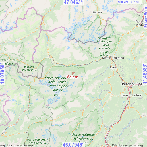
Meiern GPS coordinates[2]
46° 33' 54.108" North, 10° 46' 57.72" East
| Map corner | latitude | longitude |
|---|---|---|
| Upper-left | 47.0463°, | 10.07958° |
| Center: | 46.56503°, | 10.7827° |
| Lower-right: | 46.07946°, | 11.48583° |
| Map W x H: | 107.5×107.5 km | = 66.8×66.8mi |
| max Lat: | 47.04031° ⇑1.3% North |
| Meiern: | 46.56503° |
| min Lat: | ⇓98.7% South 35.50142° |
| min Long | Meiern | max Long |
| 6.69888° | 10.7827° | 18.48682° |
| W 40.1%⇐ | ⇒59.9% E |
Elevation
Elevation of Meiern is 1311 m = 4301 ft, and this is 1004.3 m = 3295 ft above average elevation for this country.
| Max E: |
2085 m = 6841 ft | 0.90000000000001% |
| Meiern | 1311 m 4301 ft | |
| Avg. | 306.7 m = 1006 ft | |
Min E: |
-4 m = -13 ft | 99.1% |
See also: Italy elevation on elevation.city.
Geographical zone
Meiern is located in North temperate zone (between Tropic of Cancer and the Arctic Circle). Distance of this North polar circle is 2223.6 km =1381.7 mi to North.| Distance of | km | miles | from Meiern |
|---|---|---|---|
| North Pole | 4829.5 | 3000.9 | to North |
| Arctic Circle | 2223.6 | 1381.7 | to North |
| Tropic Cancer | 2571.6 | 1597.9 | to South |
| Equator | 5177.5 | 3217.1 | to South |


Nearby cities:
15 places around Meiern: (largest is in red/bold)
• Castelbello
11.9 km =7.4 mi,  53°
53°
• Castelbello-Ciardes - Kastelbell-Tschars
11.8 km =7.3 mi, 53°
• Certosa
18.3 km =11.4 mi,  32°
32°
• Ciardes
14.7 km =9.1 mi,  56°
56°
• Coldrano
7.2 km =4.5 mi, 27°
• Ganda
1.2 km =0.7 mi,  188°
188°
• Laces
8.1 km =5 mi,  44°
44°
• Lasa
8.8 km =5.5 mi,  312°
312°
• Morter
5.6 km =3.5 mi, 33°
• Oris
12.7 km =7.9 mi,  304°
304°
• Prato Allo Stelvio
15.8 km =9.8 mi,  292°
292°
• Santa Valburga
16.7 km =10.4 mi,  95°
95°
• Silandro
7.1 km =4.4 mi,  350°
350°
• Tarres
8.5 km =5.3 mi, 56°
• Ultimo - Ulten
17 km =10.6 mi, 96°
Sources, notices
• [Note1] Compared only with cities in Italy existing in our database
• [Src1] Map data: © OpenStreetMap contributors (CC-BY-SA)
• [Src2] Other city data from geonames.org with taken over terms of usage.
• [Src3] Geographical zone / Annual Mean Temperature by Robert A. Rohde @ Wikipedia
