Pitigliano geodata
Pitigliano (Tuscany) is a populated place; located in Italy in Europe/Rome (GMT+2) time zone. With population of 4,055 people, there are 2365 cities with bigger population in this country. Compared to other cities in Italy, 60.3% of cities are located further ↑North; 55% of cities are located further ←West and 66.9% of cities have lower elevation than Pitigliano. Note1


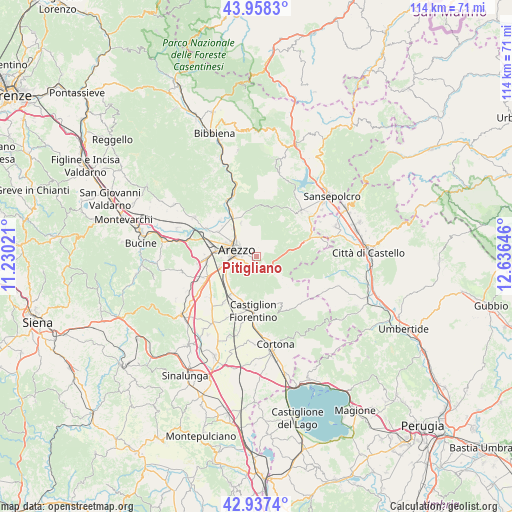
Pitigliano GPS coordinates[2]
43° 27' 0" North, 11° 55' 59.988" East
| Map corner | latitude | longitude |
|---|---|---|
| Upper-left | 43.9583°, | 11.23021° |
| Center: | 43.45°, | 11.93333° |
| Lower-right: | 42.9374°, | 12.63646° |
| Map W x H: | 113.5×113.5 km | = 70.5×70.5mi |
| max Lat: | 47.04031° ⇑60.3% North |
| Pitigliano: | 43.45° |
| min Lat: | ⇓39.7% South 35.50142° |
| min Long | Pitigliano | max Long |
| 6.69888° | 11.93333° | 18.48682° |
| W 55%⇐ | ⇒45% E |
Elevation
Elevation of Pitigliano is 362 m = 1188 ft, and this is 55.3 m = 181 ft above average elevation for this country.
| Max E: |
2085 m = 6841 ft | 33.1% |
| Pitigliano | 362 m 1188 ft | |
| Avg. | 306.7 m = 1006 ft | |
Min E: |
-4 m = -13 ft | 66.9% |
See also: Italy elevation on elevation.city.
Geographical zone
Pitigliano is located in North temperate zone (between Tropic of Cancer and the Arctic Circle). Distance of this Northern Tropic circle is 2225.3 km =1382.7 mi to South.| Distance of | km | miles | from Pitigliano |
|---|---|---|---|
| North Pole | 5175.9 | 3216.2 | to North |
| Arctic Circle | 2570 | 1596.9 | to North |
| Tropic Cancer | 2225.3 | 1382.7 | to South |
| Equator | 4831.2 | 3002 | to South |


Nearby cities:
15 places around Pitigliano: (largest is in red/bold)
• Alberoro
13.7 km =8.5 mi,  227°
227°
• Arezzo
4.5 km =2.8 mi,  288°
288°
• Badia al Pino
14 km =8.7 mi,  248°
248°
• Battifolle-Ruscello-Poggiola
10.8 km =6.7 mi,  270°
270°
• Capolona
14.2 km =8.8 mi,  336°
336°
• Castelluccio
11.5 km =7.1 mi,  315°
315°
• Castiglion Fiorentino
11.9 km =7.4 mi,  185°
185°
• Chiassa-Tregozzano
7.7 km =4.8 mi,  334°
334°
• Giovi-Ponte alla Chiassa
10.1 km =6.3 mi, 327°
• Palazzo del Pero
4.7 km =2.9 mi,  132°
132°
• Pieve al Toppo
12 km =7.5 mi, 246°
• Pratantico-Indicatore
10.9 km =6.8 mi, 288°
• Quarata
10.1 km =6.3 mi,  302°
302°
• Tegoleto
13.4 km =8.3 mi,  242°
242°
• Viciomaggio
13.1 km =8.1 mi,  261°
261°
Sources, notices
• [Note1] Compared only with cities in Italy existing in our database
• [Src1] Map data: © OpenStreetMap contributors (CC-BY-SA)
• [Src2] Other city data from geonames.org with taken over terms of usage.
• [Src3] Geographical zone / Annual Mean Temperature by Robert A. Rohde @ Wikipedia
