Perticara geodata
Perticara (Emilia-Romagna) is a populated place; located in Italy in Europe/Rome (GMT+2) time zone. With population of 633 people, there are 8758 cities with bigger population in this country. Compared to other cities in Italy, 55.7% of cities are located further ↑North; 59.2% of cities are located further ←West and 86.4% of cities have lower elevation than Perticara. Note1
Administrative division(s):
- Level 1: Emilia-Romagna
- Level 2: Provincia di Rimini
- Level 3: Novafeltria


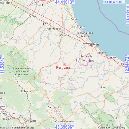
Perticara GPS coordinates[2]
43° 54' 20.52" North, 12° 14' 29.724" East
| Map corner | latitude | longitude |
|---|---|---|
| Upper-left | 44.41013°, | 11.53847° |
| Center: | 43.9057°, | 12.24159° |
| Lower-right: | 43.39696°, | 12.94472° |
| Map W x H: | 112.7×112.7 km | = 70×70mi |
| max Lat: | 47.04031° ⇑55.7% North |
| Perticara: | 43.9057° |
| min Lat: | ⇓44.3% South 35.50142° |
| min Long | Perticara | max Long |
| 6.69888° | 12.24159° | 18.48682° |
| W 59.2%⇐ | ⇒40.8% E |
Elevation
Elevation of Perticara is 641 m = 2103 ft, and this is 334.3 m = 1097 ft above average elevation for this country.
| Max E: |
2085 m = 6841 ft | 13.6% |
| Perticara | 641 m 2103 ft | |
| Avg. | 306.7 m = 1006 ft | |
Min E: |
-4 m = -13 ft | 86.4% |
See also: Italy elevation on elevation.city.
Geographical zone
Perticara is located in North temperate zone (between Tropic of Cancer and the Arctic Circle). Distance of this Northern Tropic circle is 2275.9 km =1414.2 mi to South.| Distance of | km | miles | from Perticara |
|---|---|---|---|
| North Pole | 5125.2 | 3184.7 | to North |
| Arctic Circle | 2519.3 | 1565.4 | to North |
| Tropic Cancer | 2275.9 | 1414.2 | to South |
| Equator | 4881.9 | 3033.5 | to South |


Nearby cities:
15 places around Perticara: (largest is in red/bold)
• Ca' Fusino
3.9 km =2.4 mi,  94°
94°
• Gualdo
13.3 km =8.3 mi,  347°
347°
• Mercato Saraceno
7.3 km =4.5 mi,  330°
330°
• Monte Castello
6.6 km =4.1 mi,  316°
316°
• Novafeltria
4 km =2.5 mi,  107°
107°
• Pennabilli
10 km =6.2 mi,  168°
168°
• Pietracuta
11.7 km =7.3 mi,  62°
62°
• San Leo
8.3 km =5.2 mi,  97°
97°
• Sant'Agata Feltria
5.5 km =3.4 mi,  210°
210°
• Sarsina
8.1 km =5 mi,  281°
281°
• Secchiano
6.3 km =3.9 mi,  71°
71°
• Serra di Maiolo
6.7 km =4.2 mi,  123°
123°
• Sogliano al Rubicone
12 km =7.5 mi,  23°
23°
• Talamello
3.5 km =2.2 mi, 90°
• Villagrande
11.9 km =7.4 mi,  127°
127°
Sources, notices
• [Note1] Compared only with cities in Italy existing in our database
• [Src1] Map data: © OpenStreetMap contributors (CC-BY-SA)
• [Src2] Other city data from geonames.org with taken over terms of usage.
• [Src3] Geographical zone / Annual Mean Temperature by Robert A. Rohde @ Wikipedia
