Bastardo geodata
Bastardo (Umbria) is a populated place; located in Italy in Europe/Rome (GMT+2) time zone. With population of 2,027 people, there are 4106 cities with bigger population in this country. Compared to other cities in Italy, 64.2% of cities are located further ↑North; 63.1% of cities are located further ←West and 57.9% of cities have lower elevation than Bastardo. Note1
Administrative division(s):
- Level 1: Umbria
- Level 2: Provincia di Perugia
- Level 3: Giano dell'Umbria


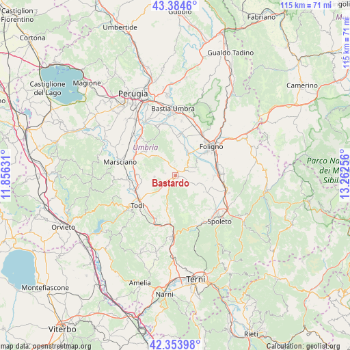
Bastardo GPS coordinates[2]
42° 52' 17.184" North, 12° 33' 33.948" East
| Map corner | latitude | longitude |
|---|---|---|
| Upper-left | 43.3846°, | 11.85631° |
| Center: | 42.87144°, | 12.55943° |
| Lower-right: | 42.35398°, | 13.26256° |
| Map W x H: | 114.6×114.6 km | = 71.2×71.2mi |
| max Lat: | 47.04031° ⇑64.2% North |
| Bastardo: | 42.87144° |
| min Lat: | ⇓35.8% South 35.50142° |
| min Long | Bastardo | max Long |
| 6.69888° | 12.55943° | 18.48682° |
| W 63.1%⇐ | ⇒36.9% E |
Elevation
Elevation of Bastardo is 285 m = 935 ft, and this is 21.7 m = 71 ft below average elevation for this country.
| Max E: |
2085 m = 6841 ft | 42.1% |
| Avg. | 306.7 m = 1006 ft | |
| Bastardo | 285 m = 935 ft | |
Min E: |
-4 m = -13 ft | 57.9% |
See also: Italy elevation on elevation.city.
Geographical zone
Bastardo is located in North temperate zone (between Tropic of Cancer and the Arctic Circle). Distance of this Northern Tropic circle is 2160.9 km =1342.7 mi to South.| Distance of | km | miles | from Bastardo |
|---|---|---|---|
| North Pole | 5240.2 | 3256.1 | to North |
| Arctic Circle | 2634.3 | 1636.9 | to North |
| Tropic Cancer | 2160.9 | 1342.7 | to South |
| Equator | 4766.9 | 2962 | to South |


Nearby cities:
15 places around Bastardo: (largest is in red/bold)
• Bevagna
8.6 km =5.3 mi,  31°
31°
• Bruna
11.9 km =7.4 mi,  118°
118°
• Cannaiola
12.6 km =7.8 mi,  93°
93°
• Castel Ritaldi
10.8 km =6.7 mi, 120°
• Collazzone
10.6 km =6.6 mi,  288°
288°
• Fiamenga
12.4 km =7.7 mi,  42°
42°
• Giano dell'Umbria
4.4 km =2.7 mi,  160°
160°
• Grutti
7.2 km =4.5 mi,  250°
250°
• Gualdo Cattaneo
4.5 km =2.8 mi,  357°
357°
• Maceratola
12.6 km =7.8 mi,  46°
46°
• Marcellano
3.5 km =2.2 mi,  274°
274°
• Massa Martana
11.3 km =7 mi,  194°
194°
• Montefalco
7.6 km =4.7 mi,  73°
73°
• Pantalla
13.1 km =8.1 mi, 270°
• San Terenziano
7 km =4.3 mi, 266°
Sources, notices
• [Note1] Compared only with cities in Italy existing in our database
• [Src1] Map data: © OpenStreetMap contributors (CC-BY-SA)
• [Src2] Other city data from geonames.org with taken over terms of usage.
• [Src3] Geographical zone / Annual Mean Temperature by Robert A. Rohde @ Wikipedia
