Semonte-Casamorcia geodata
Semonte-Casamorcia (Umbria) is a populated place; located in Italy in Europe/Rome (GMT+2) time zone. With population of 2,459 people, there are 3574 cities with bigger population in this country. Compared to other cities in Italy, 60.7% of cities are located further ↑North; 62.7% of cities are located further ←West and 74% of cities have lower elevation than Semonte-Casamorcia. Note1


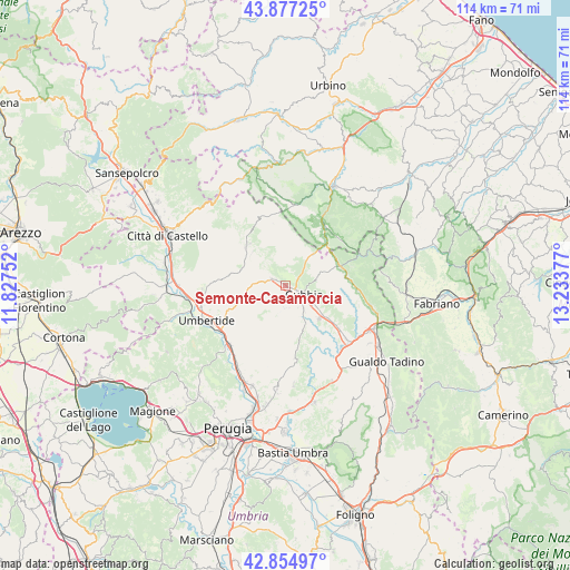
Semonte-Casamorcia GPS coordinates[2]
43° 22' 5.736" North, 12° 31' 50.304" East
| Map corner | latitude | longitude |
|---|---|---|
| Upper-left | 43.87725°, | 11.82752° |
| Center: | 43.36826°, | 12.53064° |
| Lower-right: | 42.85497°, | 13.23377° |
| Map W x H: | 113.7×113.7 km | = 70.6×70.6mi |
| max Lat: | 47.04031° ⇑60.7% North |
| Semonte-Casamorcia: | 43.36826° |
| min Lat: | ⇓39.3% South 35.50142° |
| min Long | Semonte-Casamor | max Long |
| 6.69888° | 12.53064° | 18.48682° |
| W 62.7%⇐ | ⇒37.3% E |
Elevation
Elevation of Semonte-Casamorcia is 439 m = 1440 ft, and this is 132.3 m = 434 ft above average elevation for this country.
| Max E: |
2085 m = 6841 ft | 26% |
| Semonte-Casamorcia | 439 m 1440 ft | |
| Avg. | 306.7 m = 1006 ft | |
Min E: |
-4 m = -13 ft | 74% |
See also: Italy elevation on elevation.city.
Geographical zone
Semonte-Casamorcia is located in North temperate zone (between Tropic of Cancer and the Arctic Circle). Distance of this Northern Tropic circle is 2216.2 km =1377.1 mi to South.| Distance of | km | miles | from Semonte-Casamorcia |
|---|---|---|---|
| North Pole | 5185 | 3221.8 | to North |
| Arctic Circle | 2579.1 | 1602.6 | to North |
| Tropic Cancer | 2216.2 | 1377.1 | to South |
| Equator | 4822.1 | 2996.3 | to South |


Nearby cities:
15 places around Semonte-Casamorcia: (largest is in red/bold)
• Branca
16.1 km =10 mi,  130°
130°
• Cantiano
13.9 km =8.6 mi,  34°
34°
• Casanova di Torre
13.4 km =8.3 mi, 128°
• Cipolleto
6.2 km =3.9 mi,  142°
142°
• Costacciaro
14.7 km =9.1 mi,  94°
94°
• Gubbio
4 km =2.5 mi,  120°
120°
• La Cinella
16.3 km =10.1 mi,  221°
221°
• Monte Grimano
12.1 km =7.5 mi,  334°
334°
• Montone
16.8 km =10.4 mi,  267°
267°
• Padule-San Marco
7.7 km =4.8 mi, 124°
• Pierantonio
16.3 km =10.1 mi, 224°
• Pietralunga
11.1 km =6.9 mi,  312°
312°
• Ponte d'Assi
7.4 km =4.6 mi,  150°
150°
• Scheggia
11.6 km =7.2 mi,  70°
70°
• Stazione di Padule
9.6 km =6 mi, 134°
Sources, notices
• [Note1] Compared only with cities in Italy existing in our database
• [Src1] Map data: © OpenStreetMap contributors (CC-BY-SA)
• [Src2] Other city data from geonames.org with taken over terms of usage.
• [Src3] Geographical zone / Annual Mean Temperature by Robert A. Rohde @ Wikipedia
