La Cinella geodata
La Cinella (Umbria) is a populated place; located in Italy in Europe/Rome (GMT+2) time zone. With population of 503 people, there are 9902 cities with bigger population in this country. Compared to other cities in Italy, 61.5% of cities are located further ↑North; 61.2% of cities are located further ←West and 52.1% of cities have lower elevation than La Cinella. Note1


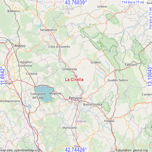
La Cinella GPS coordinates[2]
43° 15' 30.528" North, 12° 23' 50.352" East
| Map corner | latitude | longitude |
|---|---|---|
| Upper-left | 43.76839°, | 11.6942° |
| Center: | 43.25848°, | 12.39732° |
| Lower-right: | 42.74426°, | 13.10045° |
| Map W x H: | 113.9×113.9 km | = 70.8×70.8mi |
| max Lat: | 47.04031° ⇑61.5% North |
| La Cinella: | 43.25848° |
| min Lat: | ⇓38.5% South 35.50142° |
| min Long | La Cinella | max Long |
| 6.69888° | 12.39732° | 18.48682° |
| W 61.2%⇐ | ⇒38.8% E |
Elevation
Elevation of La Cinella is 247 m = 810 ft, and this is 59.7 m = 196 ft below average elevation for this country.
| Max E: |
2085 m = 6841 ft | 47.9% |
| Avg. | 306.7 m = 1006 ft | |
| La Cinella | 247 m = 810 ft | |
Min E: |
-4 m = -13 ft | 52.1% |
See also: Italy elevation on elevation.city.
Geographical zone
La Cinella is located in North temperate zone (between Tropic of Cancer and the Arctic Circle). Distance of this Northern Tropic circle is 2204 km =1369.5 mi to South.| Distance of | km | miles | from La Cinella |
|---|---|---|---|
| North Pole | 5197.2 | 3229.4 | to North |
| Arctic Circle | 2591.3 | 1610.2 | to North |
| Tropic Cancer | 2204 | 1369.5 | to South |
| Equator | 4809.9 | 2988.7 | to South |


Nearby cities:
15 places around La Cinella: (largest is in red/bold)
• Casa del Diavolo
8.9 km =5.5 mi,  151°
151°
• Colombella
13.6 km =8.5 mi, 149°
• Comparati
12.5 km =7.8 mi,  208°
208°
• Fratticiola Selvatica
14.6 km =9.1 mi,  121°
121°
• Mantignana
14.1 km =8.8 mi,  218°
218°
• Montone
12.8 km =8 mi,  332°
332°
• Oscano
12.1 km =7.5 mi,  203°
203°
• Osteria di Ramazzano
11 km =6.8 mi, 151°
• Piccione
12.6 km =7.8 mi,  133°
133°
• Pierantonio
1 km =0.6 mi,  313°
313°
• Ponte Felcino
14.8 km =9.2 mi,  163°
163°
• Ponte Pattoli
9.3 km =5.8 mi, 164°
• Resina I
6.6 km =4.1 mi, 159°
• Stazione di Parlesca e Solfagnano
4.5 km =2.8 mi, 163°
• Umbertide
7 km =4.3 mi,  315°
315°
Sources, notices
• [Note1] Compared only with cities in Italy existing in our database
• [Src1] Map data: © OpenStreetMap contributors (CC-BY-SA)
• [Src2] Other city data from geonames.org with taken over terms of usage.
• [Src3] Geographical zone / Annual Mean Temperature by Robert A. Rohde @ Wikipedia
