Stiore geodata
Stiore (Emilia-Romagna) is a populated place; located in Italy in Europe/Rome (GMT+2) time zone. With population of 745 people, there are 7978 cities with bigger population in this country. Compared to other cities in Italy, 50.6% of cities are located further ↓South; 55.7% of cities are located further →East and 64% of cities have higher elevation than Stiore. Note1


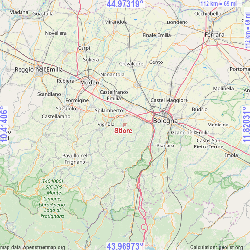
Stiore GPS coordinates[2]
44° 28' 25.032" North, 11° 7' 1.848" East
| Map corner | latitude | longitude |
|---|---|---|
| Upper-left | 44.97319°, | 10.41406° |
| Center: | 44.47362°, | 11.11718° |
| Lower-right: | 43.96973°, | 11.82031° |
| Map W x H: | 111.6×111.6 km | = 69.3×69.3mi |
| max Lat: | 47.04031° ⇑49.4% North |
| Stiore: | 44.47362° |
| min Lat: | ⇓50.6% South 35.50142° |
| min Long | Stiore | max Long |
| 6.69888° | 11.11718° | 18.48682° |
| W 44.3%⇐ | ⇒55.7% E |
Elevation
Elevation of Stiore is 134 m = 440 ft, and this is 172.7 m = 567 ft below average elevation for this country.
| Max E: |
2085 m = 6841 ft | 64% |
| Avg. | 306.7 m = 1006 ft | |
| Stiore | 134 m = 440 ft | |
Min E: |
-4 m = -13 ft | 36% |
See also: Italy elevation on elevation.city.
Geographical zone
Stiore is located in North temperate zone (between Tropic of Cancer and the Arctic Circle). Distance of this Northern Tropic circle is 2339.1 km =1453.4 mi to South.| Distance of | km | miles | from Stiore |
|---|---|---|---|
| North Pole | 5062.1 | 3145.4 | to North |
| Arctic Circle | 2456.2 | 1526.2 | to North |
| Tropic Cancer | 2339.1 | 1453.4 | to South |
| Equator | 4945 | 3072.7 | to South |


Nearby cities:
15 places around Stiore: (largest is in red/bold)
• Bazzano
4 km =2.5 mi,  322°
322°
• Calcara
8.3 km =5.2 mi,  9°
9°
• Calderino
6.7 km =4.2 mi,  105°
105°
• Castelletto
5.6 km =3.5 mi,  228°
228°
• Crespellano
4.4 km =2.7 mi,  15°
15°
• Formica
8.3 km =5.2 mi,  265°
265°
• Garofano
9.4 km =5.8 mi,  259°
259°
• Monte San Giovanni
7.4 km =4.6 mi,  143°
143°
• Mulino
6 km =3.7 mi,  290°
290°
• Piumazzo
9 km =5.6 mi,  333°
333°
• Ponte Ronca
6.5 km =4 mi,  61°
61°
• Riale
9.3 km =5.8 mi,  83°
83°
• Savignano sul Panaro
6.6 km =4.1 mi,  276°
276°
• Vignola
8.5 km =5.3 mi, 277°
• Zola Predosa
8.2 km =5.1 mi, 77°
Sources, notices
• [Note1] Compared only with cities in Italy existing in our database
• [Src1] Map data: © OpenStreetMap contributors (CC-BY-SA)
• [Src2] Other city data from geonames.org with taken over terms of usage.
• [Src3] Geographical zone / Annual Mean Temperature by Robert A. Rohde @ Wikipedia
