Costacciaro geodata
Costacciaro (Umbria) is a seat of a third-order administrative division; located in Italy in Europe/Rome (GMT+2) time zone. With population of 533 people, there are 9616 cities with bigger population in this country. Compared to other cities in Italy, 60.8% of cities are located further ↑North; 65.2% of cities are located further ←West and 81.9% of cities have lower elevation than Costacciaro. Note1


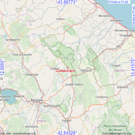
Costacciaro GPS coordinates[2]
43° 21' 31.176" North, 12° 42' 45.432" East
| Map corner | latitude | longitude |
|---|---|---|
| Upper-left | 43.86773°, | 12.0095° |
| Center: | 43.35866°, | 12.71262° |
| Lower-right: | 42.84529°, | 13.41575° |
| Map W x H: | 113.7×113.7 km | = 70.6×70.6mi |
| max Lat: | 47.04031° ⇑60.8% North |
| Costacciaro: | 43.35866° |
| min Lat: | ⇓39.2% South 35.50142° |
| min Long | Costacciaro | max Long |
| 6.69888° | 12.71262° | 18.48682° |
| W 65.2%⇐ | ⇒34.8% E |
Elevation
Elevation of Costacciaro is 554 m = 1818 ft, and this is 247.3 m = 811 ft above average elevation for this country.
| Max E: |
2085 m = 6841 ft | 18.1% |
| Costacciaro | 554 m 1818 ft | |
| Avg. | 306.7 m = 1006 ft | |
Min E: |
-4 m = -13 ft | 81.9% |
See also: Italy elevation on elevation.city.
Geographical zone
Costacciaro is located in North temperate zone (between Tropic of Cancer and the Arctic Circle). Distance of this Northern Tropic circle is 2215.1 km =1376.4 mi to South.| Distance of | km | miles | from Costacciaro |
|---|---|---|---|
| North Pole | 5186 | 3222.4 | to North |
| Arctic Circle | 2580.1 | 1603.2 | to North |
| Tropic Cancer | 2215.1 | 1376.4 | to South |
| Equator | 4821 | 2995.6 | to South |


Nearby cities:
15 places around Costacciaro: (largest is in red/bold)
• Branca
9.8 km =6.1 mi,  195°
195°
• Casanova di Torre
8.5 km =5.3 mi,  209°
209°
• Cipolleto
11.6 km =7.2 mi,  250°
250°
• Fossato di Vico
8 km =5 mi,  150°
150°
• Gubbio
11.3 km =7 mi,  265°
265°
• Marischio
12.8 km =8 mi,  99°
99°
• Osteria del Gatto
8.6 km =5.3 mi,  162°
162°
• Padule-San Marco
9 km =5.6 mi, 248°
• Palazzo Mancinelli-Vaccara
11.8 km =7.3 mi, 159°
• Ponte d'Assi
12.3 km =7.6 mi,  243°
243°
• Purello
5.9 km =3.7 mi,  142°
142°
• Sassoferrato
14.1 km =8.8 mi,  55°
55°
• Scheggia
6.3 km =3.9 mi,  322°
322°
• Sigillo
3.8 km =2.4 mi, 143°
• Stazione di Padule
9.7 km =6 mi,  234°
234°
Sources, notices
• [Note1] Compared only with cities in Italy existing in our database
• [Src1] Map data: © OpenStreetMap contributors (CC-BY-SA)
• [Src2] Other city data from geonames.org with taken over terms of usage.
• [Src3] Geographical zone / Annual Mean Temperature by Robert A. Rohde @ Wikipedia
