Esanatoglia geodata
Esanatoglia (The Marches) is a seat of a third-order administrative division; located in Italy in Europe/Rome (GMT+2) time zone. With population of 1,720 people, there are 4627 cities with bigger population in this country. Compared to other cities in Italy, 61.5% of cities are located further ↑North; 67.7% of cities are located further ←West and 74.6% of cities have lower elevation than Esanatoglia. Note1
Administrative division(s):
- Level 1: The Marches
- Level 2: Provincia di Macerata
- Level 3: Esanatoglia


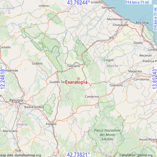
Esanatoglia GPS coordinates[2]
43° 15' 8.928" North, 12° 56' 57.48" East
| Map corner | latitude | longitude |
|---|---|---|
| Upper-left | 43.76244°, | 12.24618° |
| Center: | 43.25248°, | 12.9493° |
| Lower-right: | 42.73821°, | 13.65243° |
| Map W x H: | 113.9×113.9 km | = 70.8×70.8mi |
| max Lat: | 47.04031° ⇑61.5% North |
| Esanatoglia: | 43.25248° |
| min Lat: | ⇓38.5% South 35.50142° |
| min Long | Esanatoglia | max Long |
| 6.69888° | 12.9493° | 18.48682° |
| W 67.7%⇐ | ⇒32.3% E |
Elevation
Elevation of Esanatoglia is 446 m = 1463 ft, and this is 139.3 m = 457 ft above average elevation for this country.
| Max E: |
2085 m = 6841 ft | 25.4% |
| Esanatoglia | 446 m 1463 ft | |
| Avg. | 306.7 m = 1006 ft | |
Min E: |
-4 m = -13 ft | 74.6% |
See also: Italy elevation on elevation.city.
Geographical zone
Esanatoglia is located in North temperate zone (between Tropic of Cancer and the Arctic Circle). Distance of this Northern Tropic circle is 2203.3 km =1369.1 mi to South.| Distance of | km | miles | from Esanatoglia |
|---|---|---|---|
| North Pole | 5197.8 | 3229.8 | to North |
| Arctic Circle | 2591.9 | 1610.5 | to North |
| Tropic Cancer | 2203.3 | 1369.1 | to South |
| Equator | 4809.2 | 2988.3 | to South |


Nearby cities:
15 places around Esanatoglia: (largest is in red/bold)
• Camerino
15.9 km =9.9 mi,  142°
142°
• Castelraimondo
9.8 km =6.1 mi,  119°
119°
• Cerqueto
16.4 km =10.2 mi,  262°
262°
• Cerreto d'Esi
7.8 km =4.8 mi,  23°
23°
• Fabriano
10.4 km =6.5 mi,  338°
338°
• Fossato di Vico
16 km =9.9 mi,  287°
287°
• Gagliole
9.7 km =6 mi,  99°
99°
• Gualdo Tadino
14.1 km =8.8 mi, 259°
• Marischio
11.6 km =7.2 mi,  326°
326°
• Massa
7.3 km =4.5 mi,  191°
191°
• Matelica
4.8 km =3 mi,  82°
82°
• Osteria del Gatto
16.9 km =10.5 mi,  282°
282°
• Palazzo Mancinelli-Vaccara
15.1 km =9.4 mi,  272°
272°
• Pioraco
8.3 km =5.2 mi,  164°
164°
• Sefro
11.7 km =7.3 mi,  180°
180°
Sources, notices
• [Note1] Compared only with cities in Italy existing in our database
• [Src1] Map data: © OpenStreetMap contributors (CC-BY-SA)
• [Src2] Other city data from geonames.org with taken over terms of usage.
• [Src3] Geographical zone / Annual Mean Temperature by Robert A. Rohde @ Wikipedia
