Macchia Valfortore geodata
Macchia Valfortore (Molise) is a seat of a third-order administrative division; located in Italy in Europe/Rome (GMT+2) time zone. With population of 557 people, there are 9383 cities with bigger population in this country. Compared to other cities in Italy, 74% of cities are located further ↑North; 86.5% of cities are located further ←West and 77.4% of cities have lower elevation than Macchia Valfortore. Note1
Administrative division(s):
- Level 1: Molise
- Level 2: Provincia di Campobasso
- Level 3: Macchia Valfortore


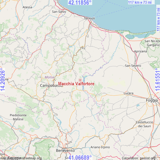
Macchia Valfortore GPS coordinates[2]
41° 35' 41.532" North, 14° 54' 44.568" East
| Map corner | latitude | longitude |
|---|---|---|
| Upper-left | 42.11856°, | 14.20926° |
| Center: | 41.59487°, | 14.91238° |
| Lower-right: | 41.06689°, | 15.61551° |
| Map W x H: | 116.9×116.9 km | = 72.6×72.6mi |
| max Lat: | 47.04031° ⇑74% North |
| Macchia Valfortore: | 41.59487° |
| min Lat: | ⇓26% South 35.50142° |
| min Long | Macchia Valfort | max Long |
| 6.69888° | 14.91238° | 18.48682° |
| W 86.5%⇐ | ⇒13.5% E |
Elevation
Elevation of Macchia Valfortore is 485 m = 1591 ft, and this is 178.3 m = 585 ft above average elevation for this country.
| Max E: |
2085 m = 6841 ft | 22.6% |
| Macchia Valfortore | 485 m 1591 ft | |
| Avg. | 306.7 m = 1006 ft | |
Min E: |
-4 m = -13 ft | 77.4% |
See also: Italy elevation on elevation.city.
Geographical zone
Macchia Valfortore is located in North temperate zone (between Tropic of Cancer and the Arctic Circle). Distance of this Northern Tropic circle is 2019 km =1254.5 mi to South.| Distance of | km | miles | from Macchia Valfortore |
|---|---|---|---|
| North Pole | 5382.1 | 3344.3 | to North |
| Arctic Circle | 2776.3 | 1725.1 | to North |
| Tropic Cancer | 2019 | 1254.5 | to South |
| Equator | 4624.9 | 2873.8 | to South |


Nearby cities:
15 places around Macchia Valfortore: (largest is in red/bold)
• Bonefro
12.4 km =7.7 mi,  8°
8°
• Campolieto
12.8 km =8 mi,  289°
289°
• Carlantino
5.4 km =3.4 mi,  91°
91°
• Celenza Valfortore
6.7 km =4.2 mi,  124°
124°
• Colletorto
8.7 km =5.4 mi,  31°
31°
• Gambatesa
9.6 km =6 mi,  179°
179°
• Jelsi
12.9 km =8 mi,  227°
227°
• Monacilioni
8.7 km =5.4 mi,  281°
281°
• Pietracatella
3.6 km =2.2 mi,  244°
244°
• San Giovanni in Galdo
13.3 km =8.3 mi,  268°
268°
• San Giuliano di Puglia
11.2 km =7 mi,  21°
21°
• San Marco la Catola
11 km =6.8 mi,  135°
135°
• Sant'Elia a Pianisi
4.2 km =2.6 mi,  312°
312°
• Toro
12.8 km =8 mi,  259°
259°
• Tufara
12.9 km =8 mi,  167°
167°
Sources, notices
• [Note1] Compared only with cities in Italy existing in our database
• [Src1] Map data: © OpenStreetMap contributors (CC-BY-SA)
• [Src2] Other city data from geonames.org with taken over terms of usage.
• [Src3] Geographical zone / Annual Mean Temperature by Robert A. Rohde @ Wikipedia
