Lavaiano geodata
Lavaiano (Tuscany) is a populated place; located in Italy in Europe/Rome (GMT+2) time zone. With population of 590 people, there are 9093 cities with bigger population in this country. Compared to other cities in Italy, 58.8% of cities are located further ↑North; 62% of cities are located further →East and 93% of cities have higher elevation than Lavaiano. Note1


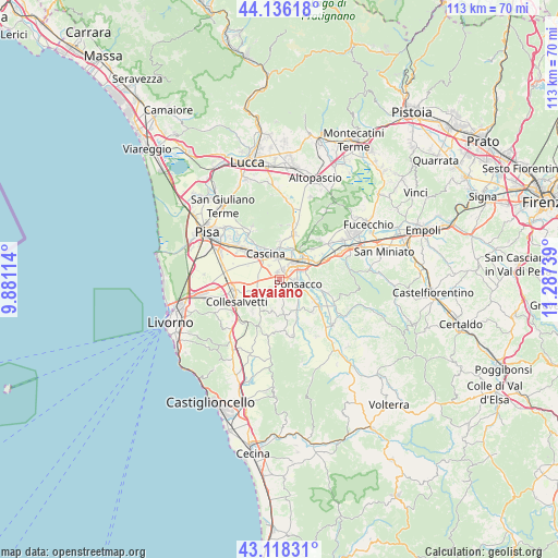
Lavaiano GPS coordinates[2]
43° 37' 45.84" North, 10° 35' 3.336" East
| Map corner | latitude | longitude |
|---|---|---|
| Upper-left | 44.13618°, | 9.88114° |
| Center: | 43.6294°, | 10.58426° |
| Lower-right: | 43.11831°, | 11.28739° |
| Map W x H: | 113.2×113.2 km | = 70.3×70.3mi |
| max Lat: | 47.04031° ⇑58.8% North |
| Lavaiano: | 43.6294° |
| min Lat: | ⇓41.2% South 35.50142° |
| min Long | Lavaiano | max Long |
| 6.69888° | 10.58426° | 18.48682° |
| W 38%⇐ | ⇒62% E |
Elevation
Elevation of Lavaiano is 12 m = 39 ft, and this is 294.7 m = 967 ft below average elevation for this country.
| Max E: |
2085 m = 6841 ft | 93% |
| Avg. | 306.7 m = 1006 ft | |
| Lavaiano | 12 m = 39 ft | |
Min E: |
-4 m = -13 ft | 7% |
See also: Italy elevation on elevation.city.
Geographical zone
Lavaiano is located in North temperate zone (between Tropic of Cancer and the Arctic Circle). Distance of this Northern Tropic circle is 2245.2 km =1395.1 mi to South.| Distance of | km | miles | from Lavaiano |
|---|---|---|---|
| North Pole | 5155.9 | 3203.7 | to North |
| Arctic Circle | 2550 | 1584.5 | to North |
| Tropic Cancer | 2245.2 | 1395.1 | to South |
| Equator | 4851.1 | 3014.3 | to South |


Nearby cities:
15 places around Lavaiano: (largest is in red/bold)
• Calcinaia
6.6 km =4.1 mi,  23°
23°
• Cascina
5.6 km =3.5 mi,  335°
335°
• Cenaia
4.7 km =2.9 mi,  236°
236°
• Chiesino-Collodi
6 km =3.7 mi, 21°
• Crespina
6.5 km =4 mi,  194°
194°
• Fornacette
4.5 km =2.8 mi,  0°
0°
• Il Romito
5.4 km =3.4 mi,  66°
66°
• La Borra
3.9 km =2.4 mi, 67°
• Latignano
3.4 km =2.1 mi,  324°
324°
• Le Casine-Perignano-Spinelli
3.3 km =2.1 mi,  181°
181°
• Ponsacco
3.5 km =2.2 mi,  101°
101°
• Pontedera
5.2 km =3.2 mi,  46°
46°
• Quattro Strade
2.9 km =1.8 mi,  202°
202°
• Santa Lucia
2.8 km =1.7 mi, 53°
• Val di Cava
5.3 km =3.3 mi,  79°
79°
Sources, notices
• [Note1] Compared only with cities in Italy existing in our database
• [Src1] Map data: © OpenStreetMap contributors (CC-BY-SA)
• [Src2] Other city data from geonames.org with taken over terms of usage.
• [Src3] Geographical zone / Annual Mean Temperature by Robert A. Rohde @ Wikipedia
