Grottole geodata
Grottole (Basilicate) is a seat of a third-order administrative division; located in Italy in Europe/Rome (GMT+2) time zone. With population of 2,174 people, there are 3905 cities with bigger population in this country. Compared to other cities in Italy, 83.5% of cities are located further ↑North; 95.7% of cities are located further ←West and 74.3% of cities have lower elevation than Grottole. Note1


Grottole GPS coordinates[2]
40° 36' 11.988" North, 16° 22' 41.916" East
| Map corner | latitude | longitude |
|---|---|---|
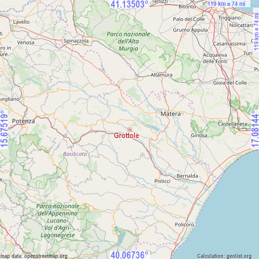
| Upper-left | 41.13503°, | 15.67519° |
| Center: | 40.60333°, | 16.37831° |
| Lower-right: | 40.06736°, | 17.08144° |
| Map W x H: | 118.7×118.7 km | = 73.8×73.8mi |
| max Lat: | 47.04031° ⇑83.5% North |
| Grottole: | 40.60333° |
| min Lat: | ⇓16.5% South 35.50142° |
| min Long | Grottole | max Long |
| 6.69888° | 16.37831° | 18.48682° |
| W 95.7%⇐ | ⇒4.3% E |
Elevation
Elevation of Grottole is 443 m = 1453 ft, and this is 136.3 m = 447 ft above average elevation for this country.
| Max E: |
2085 m = 6841 ft | 25.7% |
| Grottole | 443 m 1453 ft | |
| Avg. | 306.7 m = 1006 ft | |
Min E: |
-4 m = -13 ft | 74.3% |
See also: Italy elevation on elevation.city.
Geographical zone
Grottole is located in North temperate zone (between Tropic of Cancer and the Arctic Circle). Distance of this Northern Tropic circle is 1908.7 km =1186 mi to South.| Distance of | km | miles | from Grottole |
|---|---|---|---|
| North Pole | 5492.4 | 3412.8 | to North |
| Arctic Circle | 2886.5 | 1793.6 | to North |
| Tropic Cancer | 1908.7 | 1186 | to South |
| Equator | 4514.7 | 2805.3 | to South |


Nearby cities:
15 places around Grottole: (largest is in red/bold)
• Accettura
22.4 km =13.9 mi,  236°
236°
• Calciano
15.8 km =9.8 mi,  263°
263°
• Ferrandina
13 km =8.1 mi,  151°
151°
• Garaguso
14.1 km =8.8 mi, 244°
• Grassano
9.2 km =5.7 mi,  292°
292°
• Gravina in Puglia
24.1 km =15 mi,  8°
8°
• Irsina
20.2 km =12.6 mi,  324°
324°
• La Martella
14.8 km =9.2 mi,  63°
63°
• Matera
20.3 km =12.6 mi,  69°
69°
• Miglionico
11 km =6.8 mi,  111°
111°
• Oliveto Lucano
17.9 km =11.1 mi,  245°
245°
• Pomarico
15.1 km =9.4 mi,  123°
123°
• Salandra
9.8 km =6.1 mi,  209°
209°
• San Mauro Forte
17.1 km =10.6 mi,  218°
218°
• Tricarico
19.9 km =12.4 mi,  273°
273°
Sources, notices
• [Note1] Compared only with cities in Italy existing in our database
• [Src1] Map data: © OpenStreetMap contributors (CC-BY-SA)
• [Src2] Other city data from geonames.org with taken over terms of usage.
• [Src3] Geographical zone / Annual Mean Temperature by Robert A. Rohde @ Wikipedia
