Galeata geodata
Galeata (Emilia-Romagna) is a seat of a third-order administrative division; located in Italy in Europe/Rome (GMT+2) time zone. With population of 2,090 people, there are 4003 cities with bigger population in this country. Compared to other cities in Italy, 54.7% of cities are located further ↑North; 54.7% of cities are located further ←West and 50% of cities have lower elevation than Galeata. Note1
Administrative division(s):
- Level 1: Emilia-Romagna
- Level 2: Provincia di Forlì-Cesena
- Level 3: Galeata


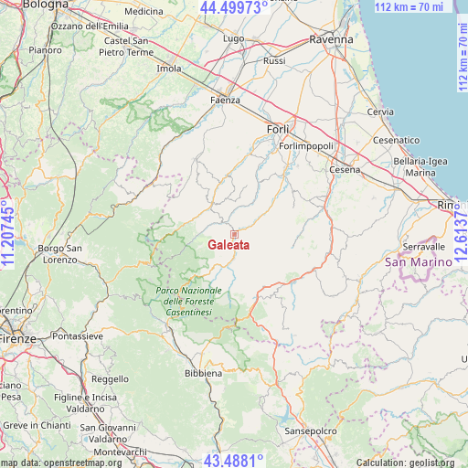
Galeata GPS coordinates[2]
43° 59' 45.852" North, 11° 54' 38.052" East
| Map corner | latitude | longitude |
|---|---|---|
| Upper-left | 44.49973°, | 11.20745° |
| Center: | 43.99607°, | 11.91057° |
| Lower-right: | 43.4881°, | 12.6137° |
| Map W x H: | 112.5×112.5 km | = 69.9×69.9mi |
| max Lat: | 47.04031° ⇑54.7% North |
| Galeata: | 43.99607° |
| min Lat: | ⇓45.3% South 35.50142° |
| min Long | Galeata | max Long |
| 6.69888° | 11.91057° | 18.48682° |
| W 54.7%⇐ | ⇒45.3% E |
Elevation
Elevation of Galeata is 235 m = 771 ft, and this is 71.7 m = 235 ft below average elevation for this country.
| Max E: |
2085 m = 6841 ft | 50% |
| Avg. | 306.7 m = 1006 ft | |
| Galeata | 235 m = 771 ft | |
Min E: |
-4 m = -13 ft | 50% |
See also: Italy elevation on elevation.city.
Geographical zone
Galeata is located in North temperate zone (between Tropic of Cancer and the Arctic Circle). Distance of this Northern Tropic circle is 2286 km =1420.5 mi to South.| Distance of | km | miles | from Galeata |
|---|---|---|---|
| North Pole | 5115.2 | 3178.4 | to North |
| Arctic Circle | 2509.3 | 1559.2 | to North |
| Tropic Cancer | 2286 | 1420.5 | to South |
| Equator | 4891.9 | 3039.7 | to South |


Nearby cities:
15 places around Galeata: (largest is in red/bold)
• Bagno di Romagna
18.3 km =11.4 mi,  167°
167°
• Civitella di Romagna
3 km =1.9 mi,  63°
63°
• Cusercoli
9.5 km =5.9 mi,  54°
54°
• Dovadola
14.1 km =8.8 mi,  352°
352°
• Fiumana
17.5 km =10.9 mi,  20°
20°
• Meldola
19 km =11.8 mi,  39°
39°
• Portico di Romagna
10.9 km =6.8 mi,  288°
288°
• Portico e San Benedetto
10.9 km =6.8 mi, 288°
• Predappio
13.3 km =8.3 mi,  26°
26°
• Premilcuore
10.4 km =6.5 mi,  260°
260°
• Rocca San Casciano
8.8 km =5.5 mi,  322°
322°
• San Colombano
15.9 km =9.9 mi, 44°
• San Piero in Bagno
16.3 km =10.1 mi,  160°
160°
• Santa Sofia
5.4 km =3.4 mi,  181°
181°
• Tredozio
16.4 km =10.2 mi,  304°
304°
Sources, notices
• [Note1] Compared only with cities in Italy existing in our database
• [Src1] Map data: © OpenStreetMap contributors (CC-BY-SA)
• [Src2] Other city data from geonames.org with taken over terms of usage.
• [Src3] Geographical zone / Annual Mean Temperature by Robert A. Rohde @ Wikipedia
