Portico e San Benedetto geodata
Portico e San Benedetto (Emilia-Romagna) is a seat of a third-order administrative division; located in Italy in Europe/Rome (GMT+2) time zone. With population of 863 people, there are 7351 cities with bigger population in this country. Compared to other cities in Italy, 54.5% of cities are located further ↑North; 52.8% of cities are located further ←West and 62.1% of cities have lower elevation than Portico e San Benedetto. Note1
Administrative division(s):
- Level 1: Emilia-Romagna
- Level 2: Provincia di Forlì-Cesena
- Level 3: Portico e San Benedetto
Current local time in Portico e San Benedetto:
05:30 PM, WednesdayDifference from your time zone: hours


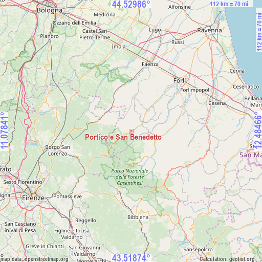
Portico e San Benedetto GPS coordinates[2]
44° 1' 35.256" North, 11° 46' 53.508" East
| Map corner | latitude | longitude |
|---|---|---|
| Upper-left | 44.52986°, | 11.07841° |
| Center: | 44.02646°, | 11.78153° |
| Lower-right: | 43.51874°, | 12.48466° |
| Map W x H: | 112.4×112.4 km | = 69.8×69.8mi |
| max Lat: | 47.04031° ⇑54.5% North |
| Portico e San Benedetto: | 44.02646° |
| min Lat: | ⇓45.5% South 35.50142° |
| min Long | Portico e San B | max Long |
| 6.69888° | 11.78153° | 18.48682° |
| W 52.8%⇐ | ⇒47.2% E |
Elevation
Elevation of Portico e San Benedetto is 316 m = 1037 ft, and this is 9.3 m = 31 ft above average elevation for this country.
| Max E: |
2085 m = 6841 ft | 37.9% |
| Portico e San Benedetto | 316 m 1037 ft | |
| Avg. | 306.7 m = 1006 ft | |
Min E: |
-4 m = -13 ft | 62.1% |
See also: Italy elevation on elevation.city.
Geographical zone
Portico e San Benedetto is located in North temperate zone (between Tropic of Cancer and the Arctic Circle). Distance of this Northern Tropic circle is 2289.4 km =1422.6 mi to South.| Distance of | km | miles | from Portico e San Benedetto |
|---|---|---|---|
| North Pole | 5111.8 | 3176.3 | to North |
| Arctic Circle | 2505.9 | 1557.1 | to North |
| Tropic Cancer | 2289.4 | 1422.6 | to South |
| Equator | 4895.3 | 3041.8 | to South |


Nearby cities:
15 places around Portico e San Benedetto: (largest is in red/bold)
• Civitella di Romagna
13.2 km =8.2 mi,  99°
99°
• Cusercoli
18.2 km =11.3 mi,  83°
83°
• Dovadola
13.6 km =8.5 mi,  38°
38°
• Fiumana
20.9 km =13 mi,  51°
51°
• Fognano
20.2 km =12.6 mi,  350°
350°
• Galeata
10.9 km =6.8 mi,  108°
108°
• Marradi
14.6 km =9.1 mi,  290°
290°
• Modigliana
14.8 km =9.2 mi,  3°
3°
• Portico di Romagna
0 km =0 mi,  307°
307°
• Predappio
18.3 km =11.4 mi,  62°
62°
• Premilcuore
5.1 km =3.2 mi,  179°
179°
• Rocca San Casciano
6.1 km =3.8 mi, 53°
• San Godenzo
17.2 km =10.7 mi,  228°
228°
• Santa Sofia
13.5 km =8.4 mi,  130°
130°
• Tredozio
6.7 km =4.2 mi,  331°
331°
Sources, notices
• [Note1] Compared only with cities in Italy existing in our database
• [Src1] Map data: © OpenStreetMap contributors (CC-BY-SA)
• [Src2] Other city data from geonames.org with taken over terms of usage.
• [Src3] Geographical zone / Annual Mean Temperature by Robert A. Rohde @ Wikipedia
