Portico di Romagna geodata
Portico di Romagna (Emilia-Romagna) is a seat of a third-order administrative division; located in Italy in Europe/Rome (GMT+2) time zone. With population of 315 people, there are 10617 cities with bigger population in this country. Compared to other cities in Italy, 54.4% of cities are located further ↑North; 52.8% of cities are located further ←West and 62.1% of cities have lower elevation than Portico di Romagna. Note1
Administrative division(s):
- Level 1: Emilia-Romagna
- Level 2: Provincia di Forlì-Cesena
- Level 3: Portico e San Benedetto


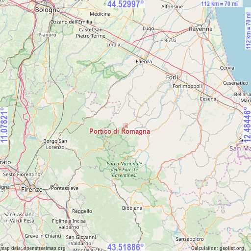
Portico di Romagna GPS coordinates[2]
44° 1' 35.652" North, 11° 46' 52.788" East
| Map corner | latitude | longitude |
|---|---|---|
| Upper-left | 44.52997°, | 11.07821° |
| Center: | 44.02657°, | 11.78133° |
| Lower-right: | 43.51886°, | 12.48446° |
| Map W x H: | 112.4×112.4 km | = 69.8×69.8mi |
| max Lat: | 47.04031° ⇑54.4% North |
| Portico di Romagna: | 44.02657° |
| min Lat: | ⇓45.6% South 35.50142° |
| min Long | Portico di Roma | max Long |
| 6.69888° | 11.78133° | 18.48682° |
| W 52.8%⇐ | ⇒47.2% E |
Elevation
Elevation of Portico di Romagna is 316 m = 1037 ft, and this is 9.3 m = 31 ft above average elevation for this country.
| Max E: |
2085 m = 6841 ft | 37.9% |
| Portico di Romagna | 316 m 1037 ft | |
| Avg. | 306.7 m = 1006 ft | |
Min E: |
-4 m = -13 ft | 62.1% |
See also: Italy elevation on elevation.city.
Geographical zone
Portico di Romagna is located in North temperate zone (between Tropic of Cancer and the Arctic Circle). Distance of this Northern Tropic circle is 2289.4 km =1422.6 mi to South.| Distance of | km | miles | from Portico di Romagna |
|---|---|---|---|
| North Pole | 5111.8 | 3176.3 | to North |
| Arctic Circle | 2505.9 | 1557.1 | to North |
| Tropic Cancer | 2289.4 | 1422.6 | to South |
| Equator | 4895.3 | 3041.8 | to South |


Nearby cities:
15 places around Portico di Romagna: (largest is in red/bold)
• Civitella di Romagna
13.2 km =8.2 mi,  99°
99°
• Cusercoli
18.2 km =11.3 mi,  83°
83°
• Dovadola
13.6 km =8.5 mi,  38°
38°
• Fiumana
20.9 km =13 mi,  51°
51°
• Fognano
20.2 km =12.6 mi,  350°
350°
• Galeata
10.9 km =6.8 mi,  108°
108°
• Marradi
14.6 km =9.1 mi,  290°
290°
• Modigliana
14.8 km =9.2 mi,  3°
3°
• Portico e San Benedetto
0 km =0 mi,  127°
127°
• Predappio
18.3 km =11.4 mi,  62°
62°
• Premilcuore
5.1 km =3.2 mi,  179°
179°
• Rocca San Casciano
6.1 km =3.8 mi, 53°
• San Godenzo
17.2 km =10.7 mi,  228°
228°
• Santa Sofia
13.5 km =8.4 mi, 130°
• Tredozio
6.7 km =4.2 mi,  331°
331°
Sources, notices
• [Note1] Compared only with cities in Italy existing in our database
• [Src1] Map data: © OpenStreetMap contributors (CC-BY-SA)
• [Src2] Other city data from geonames.org with taken over terms of usage.
• [Src3] Geographical zone / Annual Mean Temperature by Robert A. Rohde @ Wikipedia
