Civitella di Romagna geodata
Civitella di Romagna (Emilia-Romagna) is a seat of a third-order administrative division; located in Italy in Europe/Rome (GMT+2) time zone. With population of 1,523 people, there are 5070 cities with bigger population in this country. Compared to other cities in Italy, 54.6% of cities are located further ↑North; 55.1% of cities are located further ←West and 54.2% of cities have higher elevation than Civitella di Romagna. Note1
Administrative division(s):
- Level 1: Emilia-Romagna
- Level 2: Provincia di Forlì-Cesena
- Level 3: Civitella di Romagna
Current local time in Civitella di Romagna:
05:04 PM, WednesdayDifference from your time zone: hours


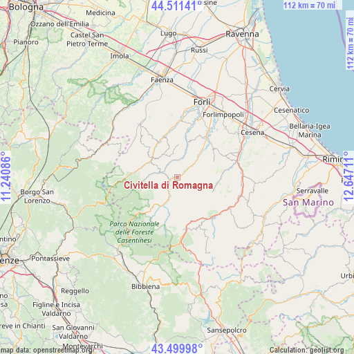
Civitella di Romagna GPS coordinates[2]
44° 0' 28.26" North, 11° 56' 38.328" East
| Map corner | latitude | longitude |
|---|---|---|
| Upper-left | 44.51141°, | 11.24086° |
| Center: | 44.00785°, | 11.94398° |
| Lower-right: | 43.49998°, | 12.64711° |
| Map W x H: | 112.5×112.5 km | = 69.9×69.9mi |
| max Lat: | 47.04031° ⇑54.6% North |
| Civitella di Romagna: | 44.00785° |
| min Lat: | ⇓45.4% South 35.50142° |
| min Long | Civitella di Ro | max Long |
| 6.69888° | 11.94398° | 18.48682° |
| W 55.1%⇐ | ⇒44.9% E |
Elevation
Elevation of Civitella di Romagna is 208 m = 682 ft, and this is 98.7 m = 324 ft below average elevation for this country.
| Max E: |
2085 m = 6841 ft | 54.2% |
| Avg. | 306.7 m = 1006 ft | |
| Civitella di Romagna | 208 m = 682 ft | |
Min E: |
-4 m = -13 ft | 45.8% |
See also: Italy elevation on elevation.city.
Geographical zone
Civitella di Romagna is located in North temperate zone (between Tropic of Cancer and the Arctic Circle). Distance of this Northern Tropic circle is 2287.3 km =1421.3 mi to South.| Distance of | km | miles | from Civitella di Romagna |
|---|---|---|---|
| North Pole | 5113.8 | 3177.6 | to North |
| Arctic Circle | 2508 | 1558.4 | to North |
| Tropic Cancer | 2287.3 | 1421.3 | to South |
| Equator | 4893.2 | 3040.5 | to South |


Nearby cities:
15 places around Civitella di Romagna: (largest is in red/bold)
• Cusercoli
6.5 km =4 mi,  50°
50°
• Dovadola
13.5 km =8.4 mi,  340°
340°
• Fiumana
15.4 km =9.6 mi,  12°
12°
• Galeata
3 km =1.9 mi,  243°
243°
• Meldola
16.4 km =10.2 mi,  35°
35°
• Portico di Romagna
13.2 km =8.2 mi,  279°
279°
• Portico e San Benedetto
13.2 km =8.2 mi, 279°
• Predappio
11.1 km =6.9 mi,  16°
16°
• Premilcuore
13.3 km =8.3 mi,  256°
256°
• Rocca San Casciano
9.9 km =6.2 mi,  304°
304°
• San Colombano
13.1 km =8.1 mi, 39°
• San Lorenzo in Noceto
17.8 km =11.1 mi, 16°
• San Piero in Bagno
16.9 km =10.5 mi,  170°
170°
• Santa Sofia
7.3 km =4.5 mi,  202°
202°
• Tredozio
18 km =11.2 mi, 296°
Sources, notices
• [Note1] Compared only with cities in Italy existing in our database
• [Src1] Map data: © OpenStreetMap contributors (CC-BY-SA)
• [Src2] Other city data from geonames.org with taken over terms of usage.
• [Src3] Geographical zone / Annual Mean Temperature by Robert A. Rohde @ Wikipedia
