Castions geodata
Castions (Friuli Venezia Giulia) is a populated place; located in Italy in Europe/Rome (GMT+2) time zone. With population of 3,782 people, there are 2521 cities with bigger population in this country. Compared to other cities in Italy, 91.2% of cities are located further ↓South; 66.1% of cities are located further ←West and 82.7% of cities have higher elevation than Castions. Note1
Administrative division(s):
- Level 1: Friuli Venezia Giulia
- Level 2: Provincia di Pordenone
- Level 3: Zoppola


Castions GPS coordinates[2]
45° 58' 19.848" North, 12° 47' 58.596" East
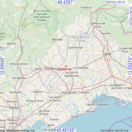
| Map corner | latitude | longitude |
|---|---|---|
| Upper-left | 46.4587°, | 12.09649° |
| Center: | 45.97218°, | 12.79961° |
| Lower-right: | 45.48135°, | 13.50274° |
| Map W x H: | 108.7×108.7 km | = 67.5×67.5mi |
| max Lat: | 47.04031° ⇑8.8% North |
| Castions: | 45.97218° |
| min Lat: | ⇓91.2% South 35.50142° |
| min Long | Castions | max Long |
| 6.69888° | 12.79961° | 18.48682° |
| W 66.1%⇐ | ⇒33.9% E |
Elevation
Elevation of Castions is 39 m = 128 ft, and this is 267.7 m = 878 ft below average elevation for this country.
| Max E: |
2085 m = 6841 ft | 82.7% |
| Avg. | 306.7 m = 1006 ft | |
| Castions | 39 m = 128 ft | |
Min E: |
-4 m = -13 ft | 17.3% |
See also: Italy elevation on elevation.city.
Geographical zone
Castions is located in North temperate zone (between Tropic of Cancer and the Arctic Circle). Distance of this North polar circle is 2289.5 km =1422.6 mi to North.| Distance of | km | miles | from Castions |
|---|---|---|---|
| North Pole | 4895.4 | 3041.9 | to North |
| Arctic Circle | 2289.5 | 1422.6 | to North |
| Tropic Cancer | 2505.7 | 1557 | to South |
| Equator | 5111.6 | 3176.2 | to South |


Nearby cities:
15 places around Castions: (largest is in red/bold)
• Arzene
5 km =3.1 mi,  52°
52°
• Casarsa della Delizia
4.1 km =2.5 mi,  125°
125°
• Cinque Strade-Cimpello
9.9 km =6.2 mi,  231°
231°
• Cordenons
7.8 km =4.8 mi,  279°
279°
• Fiume Veneto
6.8 km =4.2 mi,  224°
224°
• Musil
8 km =5 mi,  267°
267°
• Orcenico Inferiore
3.7 km =2.3 mi, 227°
• Rauscedo-Domanins
7.9 km =4.9 mi,  14°
14°
• Rosa
7.2 km =4.5 mi, 130°
• San Giorgio della Richinvelda
10 km =6.2 mi,  32°
32°
• San Martino al Tagliamento
7.4 km =4.6 mi, 47°
• San Vito al Tagliamento
7.7 km =4.8 mi,  143°
143°
• Savorgnano
9.4 km =5.8 mi,  153°
153°
• Valvasone
5.7 km =3.5 mi,  65°
65°
• Zoppola
2.5 km =1.6 mi,  254°
254°
Sources, notices
• [Note1] Compared only with cities in Italy existing in our database
• [Src1] Map data: © OpenStreetMap contributors (CC-BY-SA)
• [Src2] Other city data from geonames.org with taken over terms of usage.
• [Src3] Geographical zone / Annual Mean Temperature by Robert A. Rohde @ Wikipedia
