Ferriere geodata
Ferriere (Emilia-Romagna) is a seat of a third-order administrative division; located in Italy in Europe/Rome (GMT+2) time zone. With population of 314 people, there are 10622 cities with bigger population in this country. Compared to other cities in Italy, 53.3% of cities are located further ↓South; 73.3% of cities are located further →East and 86.7% of cities have lower elevation than Ferriere. Note1
Administrative division(s):
- Level 1: Emilia-Romagna
- Level 2: Provincia di Piacenza
- Level 3: Ferriere


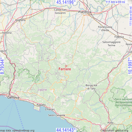
Ferriere GPS coordinates[2]
44° 38' 37.86" North, 9° 29' 47.652" East
| Map corner | latitude | longitude |
|---|---|---|
| Upper-left | 45.14196°, | 8.79344° |
| Center: | 44.64385°, | 9.49657° |
| Lower-right: | 44.14143°, | 10.1997° |
| Map W x H: | 111.2×111.2 km | = 69.1×69.1mi |
| max Lat: | 47.04031° ⇑46.7% North |
| Ferriere: | 44.64385° |
| min Lat: | ⇓53.3% South 35.50142° |
| min Long | Ferriere | max Long |
| 6.69888° | 9.49657° | 18.48682° |
| W 26.7%⇐ | ⇒73.3% E |
Elevation
Elevation of Ferriere is 647 m = 2123 ft, and this is 340.3 m = 1116 ft above average elevation for this country.
| Max E: |
2085 m = 6841 ft | 13.3% |
| Ferriere | 647 m 2123 ft | |
| Avg. | 306.7 m = 1006 ft | |
Min E: |
-4 m = -13 ft | 86.7% |
See also: Italy elevation on elevation.city.
Geographical zone
Ferriere is located in North temperate zone (between Tropic of Cancer and the Arctic Circle). Distance of this Northern Tropic circle is 2358 km =1465.2 mi to South.| Distance of | km | miles | from Ferriere |
|---|---|---|---|
| North Pole | 5043.1 | 3133.6 | to North |
| Arctic Circle | 2437.2 | 1514.4 | to North |
| Tropic Cancer | 2358 | 1465.2 | to South |
| Equator | 4963.9 | 3084.4 | to South |


Nearby cities:
15 places around Ferriere: (largest is in red/bold)
• Bardi
18.4 km =11.4 mi,  94°
94°
• Bettola
17.4 km =10.8 mi,  30°
30°
• Bobbio
16.4 km =10.2 mi,  327°
327°
• Cerignale
12.1 km =7.5 mi,  288°
288°
• Coli
13.1 km =8.1 mi, 330°
• Farini
9.6 km =6 mi,  36°
36°
• Fontanigorda
18.7 km =11.6 mi,  234°
234°
• Gorreto
16.8 km =10.4 mi,  255°
255°
• Marsaglia
11.7 km =7.3 mi,  310°
310°
• Morfasso
18.5 km =11.5 mi,  61°
61°
• Ottone
13.2 km =8.2 mi, 259°
• Rezzoaglio
15.6 km =9.7 mi,  213°
213°
• San Giovanni-San Bernardino
18.8 km =11.7 mi, 28°
• Santo Stefano d'Aveto
11.3 km =7 mi,  197°
197°
• Zerba
16.7 km =10.4 mi,  278°
278°
Sources, notices
• [Note1] Compared only with cities in Italy existing in our database
• [Src1] Map data: © OpenStreetMap contributors (CC-BY-SA)
• [Src2] Other city data from geonames.org with taken over terms of usage.
• [Src3] Geographical zone / Annual Mean Temperature by Robert A. Rohde @ Wikipedia
