Boara geodata
Boara (Emilia-Romagna) is a populated place; located in Italy in Europe/Rome (GMT+2) time zone. With population of 902 people, there are 7138 cities with bigger population in this country. Compared to other cities in Italy, 57.3% of cities are located further ↓South; 51.6% of cities are located further ←West and 96.6% of cities have higher elevation than Boara. Note1


Boara GPS coordinates[2]
44° 51' 48.852" North, 11° 41' 6.936" East
| Map corner | latitude | longitude |
|---|---|---|
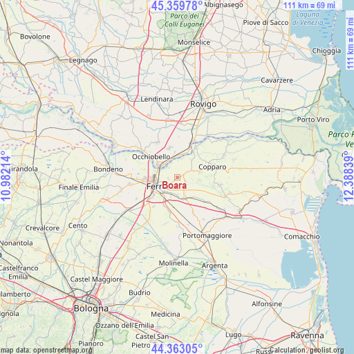
| Upper-left | 45.35978°, | 10.98214° |
| Center: | 44.86357°, | 11.68526° |
| Lower-right: | 44.36305°, | 12.38839° |
| Map W x H: | 110.8×110.8 km | = 68.8×68.8mi |
| max Lat: | 47.04031° ⇑42.7% North |
| Boara: | 44.86357° |
| min Lat: | ⇓57.3% South 35.50142° |
| min Long | Boara | max Long |
| 6.69888° | 11.68526° | 18.48682° |
| W 51.6%⇐ | ⇒48.4% E |
Elevation
Elevation of Boara is 6 m = 20 ft, and this is 300.7 m = 987 ft below average elevation for this country.
| Max E: |
2085 m = 6841 ft | 96.6% |
| Avg. | 306.7 m = 1006 ft | |
| Boara | 6 m = 20 ft | |
Min E: |
-4 m = -13 ft | 3.4% |
See also: Italy elevation on elevation.city.
Geographical zone
Boara is located in North temperate zone (between Tropic of Cancer and the Arctic Circle). Distance of this Northern Tropic circle is 2382.4 km =1480.4 mi to South.| Distance of | km | miles | from Boara |
|---|---|---|---|
| North Pole | 5018.7 | 3118.5 | to North |
| Arctic Circle | 2412.8 | 1499.2 | to North |
| Tropic Cancer | 2382.4 | 1480.4 | to South |
| Equator | 4988.4 | 3099.6 | to South |


Nearby cities:
15 places around Boara: (largest is in red/bold)
• Aguscello
6.6 km =4.1 mi,  197°
197°
• Baura
2.9 km =1.8 mi,  115°
115°
• Canaro
7.9 km =4.9 mi,  354°
354°
• Cona
6.6 km =4.1 mi,  165°
165°
• Ferrara
5.8 km =3.6 mi,  240°
240°
• Fossanova San Marco
9.2 km =5.7 mi,  208°
208°
• Francolino
4.3 km =2.7 mi,  328°
328°
• Gaibanella-Sant'Edigio
11.1 km =6.9 mi,  194°
194°
• La Saletta-Tamara
7.1 km =4.4 mi,  73°
73°
• Occhiobello
10.5 km =6.5 mi,  308°
308°
• Pontegradella
3.3 km =2.1 mi, 212°
• Porotto-Cassama
10.8 km =6.7 mi,  261°
261°
• Quartesana
7.8 km =4.8 mi,  147°
147°
• Ro
11 km =6.8 mi,  32°
32°
• Santa Maria Maddalena
7.5 km =4.7 mi,  304°
304°
Sources, notices
• [Note1] Compared only with cities in Italy existing in our database
• [Src1] Map data: © OpenStreetMap contributors (CC-BY-SA)
• [Src2] Other city data from geonames.org with taken over terms of usage.
• [Src3] Geographical zone / Annual Mean Temperature by Robert A. Rohde @ Wikipedia
