Cona geodata
Cona (Emilia-Romagna) is a section of populated place; located in Italy in Europe/Rome (GMT+2) time zone. With population of 1,118 people, there are 6220 cities with bigger population in this country. Compared to other cities in Italy, 56.3% of cities are located further ↓South; 51.9% of cities are located further ←West and 95.3% of cities have higher elevation than Cona. Note1


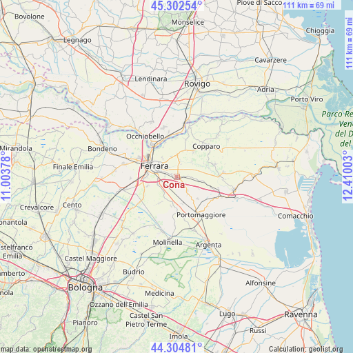
Cona GPS coordinates[2]
44° 48' 20.988" North, 11° 42' 24.84" East
| Map corner | latitude | longitude |
|---|---|---|
| Upper-left | 45.30254°, | 11.00378° |
| Center: | 44.80583°, | 11.7069° |
| Lower-right: | 44.30481°, | 12.41003° |
| Map W x H: | 110.9×110.9 km | = 68.9×68.9mi |
| max Lat: | 47.04031° ⇑43.7% North |
| Cona: | 44.80583° |
| min Lat: | ⇓56.3% South 35.50142° |
| min Long | Cona | max Long |
| 6.69888° | 11.7069° | 18.48682° |
| W 51.9%⇐ | ⇒48.1% E |
Elevation
Elevation of Cona is 8 m = 26 ft, and this is 298.7 m = 980 ft below average elevation for this country.
| Max E: |
2085 m = 6841 ft | 95.3% |
| Avg. | 306.7 m = 1006 ft | |
| Cona | 8 m = 26 ft | |
Min E: |
-4 m = -13 ft | 4.7% |
See also: Italy elevation on elevation.city.
Geographical zone
Cona is located in North temperate zone (between Tropic of Cancer and the Arctic Circle). Distance of this Northern Tropic circle is 2376 km =1476.4 mi to South.| Distance of | km | miles | from Cona |
|---|---|---|---|
| North Pole | 5025.1 | 3122.5 | to North |
| Arctic Circle | 2419.2 | 1503.2 | to North |
| Tropic Cancer | 2376 | 1476.4 | to South |
| Equator | 4981.9 | 3095.6 | to South |


Nearby cities:
15 places around Cona: (largest is in red/bold)
• Aguscello
3.7 km =2.3 mi,  271°
271°
• Baura
5.2 km =3.2 mi,  10°
10°
• Boara
6.6 km =4.1 mi,  345°
345°
• Ferrara
7.7 km =4.8 mi,  297°
297°
• Fossanova San Marco
6.3 km =3.9 mi,  254°
254°
• Gaibanella-Sant'Edigio
6.3 km =3.9 mi,  225°
225°
• Gambulaga
9.5 km =5.9 mi,  136°
136°
• La Saletta-Tamara
9.9 km =6.2 mi,  31°
31°
• Marrara
9.3 km =5.8 mi,  190°
190°
• Masi-Torello
7.6 km =4.7 mi,  99°
99°
• Monestirolo
8 km =5 mi, 190°
• Pontegradella
5 km =3.1 mi,  315°
315°
• Quartesana
2.5 km =1.6 mi,  92°
92°
• San Martino
9.9 km =6.2 mi, 251°
• Voghiera
6.6 km =4.1 mi,  147°
147°
Sources, notices
• [Note1] Compared only with cities in Italy existing in our database
• [Src1] Map data: © OpenStreetMap contributors (CC-BY-SA)
• [Src2] Other city data from geonames.org with taken over terms of usage.
• [Src3] Geographical zone / Annual Mean Temperature by Robert A. Rohde @ Wikipedia
