Selcetta geodata
Selcetta (Latium) is a populated place; located in Italy in Europe/Rome (GMT+2) time zone. With population of 6,772 people, there are 1449 cities with bigger population in this country. Compared to other cities in Italy, 72.3% of cities are located further ↑North; 62.1% of cities are located further ←West and 76.6% of cities have higher elevation than Selcetta. Note1
Administrative division(s):
- Level 1: Latium
- Level 2: Città metropolitana di Roma Capitale
- Level 3: Roma Capitale
- Level 4: Municipio Roma IX


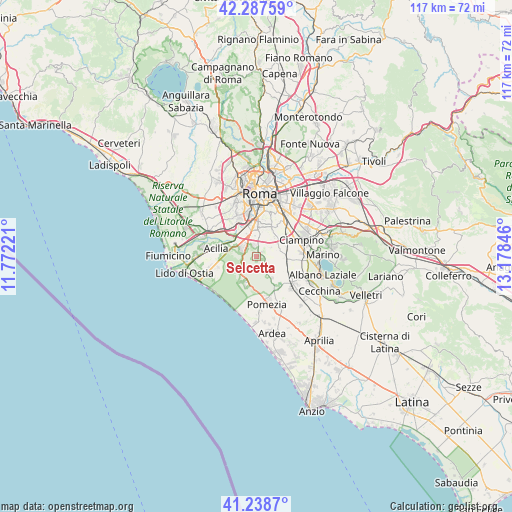
Selcetta GPS coordinates[2]
41° 45' 55.044" North, 12° 28' 31.188" East
| Map corner | latitude | longitude |
|---|---|---|
| Upper-left | 42.28759°, | 11.77221° |
| Center: | 41.76529°, | 12.47533° |
| Lower-right: | 41.2387°, | 13.17846° |
| Map W x H: | 116.6×116.6 km | = 72.5×72.5mi |
| max Lat: | 47.04031° ⇑72.3% North |
| Selcetta: | 41.76529° |
| min Lat: | ⇓27.7% South 35.50142° |
| min Long | Selcetta | max Long |
| 6.69888° | 12.47533° | 18.48682° |
| W 62.1%⇐ | ⇒37.9% E |
Elevation
Elevation of Selcetta is 66 m = 217 ft, and this is 240.7 m = 790 ft below average elevation for this country.
| Max E: |
2085 m = 6841 ft | 76.6% |
| Avg. | 306.7 m = 1006 ft | |
| Selcetta | 66 m = 217 ft | |
Min E: |
-4 m = -13 ft | 23.4% |
See also: Italy elevation on elevation.city.
Geographical zone
Selcetta is located in North temperate zone (between Tropic of Cancer and the Arctic Circle). Distance of this Northern Tropic circle is 2037.9 km =1266.3 mi to South.| Distance of | km | miles | from Selcetta |
|---|---|---|---|
| North Pole | 5363.2 | 3332.5 | to North |
| Arctic Circle | 2757.3 | 1713.3 | to North |
| Tropic Cancer | 2037.9 | 1266.3 | to South |
| Equator | 4643.9 | 2885.6 | to South |


Nearby cities:
15 places around Selcetta: (largest is in red/bold)
• Acilia-Castel Fusano-Ostia Antica
12 km =7.5 mi,  268°
268°
• Area Produttiva
9.6 km =6 mi,  164°
164°
• Borgo Lotti
6.6 km =4.1 mi,  91°
91°
• Casal Palocco
10.8 km =6.7 mi,  260°
260°
• Castel di Leva
6 km =3.7 mi,  77°
77°
• Ciampino
11.2 km =7 mi,  69°
69°
• Colle del Pino
3.1 km =1.9 mi,  145°
145°
• Colli di Enea
12.3 km =7.6 mi,  174°
174°
• Monte Migliore La Selvotta
5.4 km =3.4 mi, 155°
• Pavona
12.5 km =7.8 mi,  110°
110°
• Pomezia
10.9 km =6.8 mi, 168°
• Santa Palomba-Roma II
10.5 km =6.5 mi,  130°
130°
• Spregamore
7.1 km =4.4 mi,  117°
117°
• Stazione di Pavona-Palazzo Margana
10.8 km =6.7 mi, 118°
• Vitinia
6.3 km =3.9 mi,  297°
297°
Sources, notices
• [Note1] Compared only with cities in Italy existing in our database
• [Src1] Map data: © OpenStreetMap contributors (CC-BY-SA)
• [Src2] Other city data from geonames.org with taken over terms of usage.
• [Src3] Geographical zone / Annual Mean Temperature by Robert A. Rohde @ Wikipedia
