Ravina geodata
Ravina (Trentino-Alto Adige) is a populated place; located in Italy in Europe/Rome (GMT+2) time zone. With population of 3,093 people, there are 2967 cities with bigger population in this country. Compared to other cities in Italy, 92.8% of cities are located further ↓South; 55.7% of cities are located further →East and 52% of cities have higher elevation than Ravina. Note1
Administrative division(s):
- Level 1: Trentino-Alto Adige
- Level 2: Provincia autonoma di Trento
- Level 3: Trento


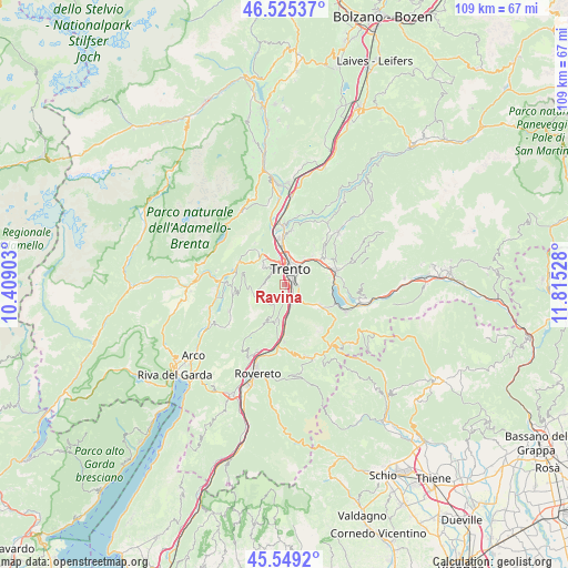
Ravina GPS coordinates[2]
46° 2' 21.984" North, 11° 6' 43.74" East
| Map corner | latitude | longitude |
|---|---|---|
| Upper-left | 46.52537°, | 10.40903° |
| Center: | 46.03944°, | 11.11215° |
| Lower-right: | 45.5492°, | 11.81528° |
| Map W x H: | 108.5×108.5 km | = 67.4×67.4mi |
| max Lat: | 47.04031° ⇑7.2% North |
| Ravina: | 46.03944° |
| min Lat: | ⇓92.8% South 35.50142° |
| min Long | Ravina | max Long |
| 6.69888° | 11.11215° | 18.48682° |
| W 44.3%⇐ | ⇒55.7% E |
Elevation
Elevation of Ravina is 222 m = 728 ft, and this is 84.7 m = 278 ft below average elevation for this country.
| Max E: |
2085 m = 6841 ft | 52% |
| Avg. | 306.7 m = 1006 ft | |
| Ravina | 222 m = 728 ft | |
Min E: |
-4 m = -13 ft | 48% |
See also: Italy elevation on elevation.city.
Geographical zone
Ravina is located in North temperate zone (between Tropic of Cancer and the Arctic Circle). Distance of this North polar circle is 2282.1 km =1418 mi to North.| Distance of | km | miles | from Ravina |
|---|---|---|---|
| North Pole | 4888 | 3037.3 | to North |
| Arctic Circle | 2282.1 | 1418 | to North |
| Tropic Cancer | 2513.2 | 1561.6 | to South |
| Equator | 5119.1 | 3180.9 | to South |


Nearby cities:
15 places around Ravina: (largest is in red/bold)
• Aldeno
7 km =4.3 mi,  192°
192°
• Cadine
6.5 km =4 mi,  328°
328°
• Cimoneri
6.9 km =4.3 mi,  207°
207°
• Civezzano
8 km =5 mi,  44°
44°
• Covelo
7.5 km =4.7 mi, 206°
• Garniga Nuova
4.5 km =2.8 mi, 205°
• Mattarello
3.7 km =2.3 mi,  158°
158°
• Povo
4.5 km =2.8 mi,  47°
47°
• Romagnano
2.4 km =1.5 mi, 191°
• Sardagna
3 km =1.9 mi,  335°
335°
• Tavernaro
5.9 km =3.7 mi, 35°
• Trento
3.2 km =2 mi,  12°
12°
• Vela
4.8 km =3 mi,  350°
350°
• Vigolo Vattaro
7.6 km =4.7 mi,  119°
119°
• Villamontagna
6.4 km =4 mi,  34°
34°
Sources, notices
• [Note1] Compared only with cities in Italy existing in our database
• [Src1] Map data: © OpenStreetMap contributors (CC-BY-SA)
• [Src2] Other city data from geonames.org with taken over terms of usage.
• [Src3] Geographical zone / Annual Mean Temperature by Robert A. Rohde @ Wikipedia
