Sferracavallo geodata
Sferracavallo (Umbria) is a populated place; located in Italy in Europe/Rome (GMT+2) time zone. With population of 1,990 people, there are 4178 cities with bigger population in this country. Compared to other cities in Italy, 65% of cities are located further ↑North; 57.2% of cities are located further ←West and 61.8% of cities have higher elevation than Sferracavallo. Note1


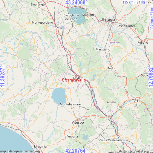
Sferracavallo GPS coordinates[2]
42° 43' 34.716" North, 12° 5' 44.484" East
| Map corner | latitude | longitude |
|---|---|---|
| Upper-left | 43.24068°, | 11.39257° |
| Center: | 42.72631°, | 12.09569° |
| Lower-right: | 42.20764°, | 12.79882° |
| Map W x H: | 114.9×114.9 km | = 71.4×71.4mi |
| max Lat: | 47.04031° ⇑65% North |
| Sferracavallo: | 42.72631° |
| min Lat: | ⇓35% South 35.50142° |
| min Long | Sferracavallo | max Long |
| 6.69888° | 12.09569° | 18.48682° |
| W 57.2%⇐ | ⇒42.8% E |
Elevation
Elevation of Sferracavallo is 150 m = 492 ft, and this is 156.7 m = 514 ft below average elevation for this country.
| Max E: |
2085 m = 6841 ft | 61.8% |
| Avg. | 306.7 m = 1006 ft | |
| Sferracavallo | 150 m = 492 ft | |
Min E: |
-4 m = -13 ft | 38.2% |
See also: Italy elevation on elevation.city.
Geographical zone
Sferracavallo is located in North temperate zone (between Tropic of Cancer and the Arctic Circle). Distance of this Northern Tropic circle is 2144.8 km =1332.7 mi to South.| Distance of | km | miles | from Sferracavallo |
|---|---|---|---|
| North Pole | 5256.3 | 3266.1 | to North |
| Arctic Circle | 2650.5 | 1646.9 | to North |
| Tropic Cancer | 2144.8 | 1332.7 | to South |
| Equator | 4750.7 | 2951.9 | to South |


Nearby cities:
15 places around Sferracavallo: (largest is in red/bold)
• Bagnoregio
10.9 km =6.8 mi,  182°
182°
• Baschi
11.6 km =7.2 mi,  120°
120°
• Canale Nuovo
5.2 km =3.2 mi,  145°
145°
• Castel Giorgio
9.9 km =6.2 mi,  257°
257°
• Castel Viscardo
8.3 km =5.2 mi,  291°
291°
• Castiglione in Teverina
12.1 km =7.5 mi,  133°
133°
• Ciconia
3.2 km =2 mi,  75°
75°
• Ficulle
12 km =7.5 mi,  349°
349°
• Lubriano
10.1 km =6.3 mi,  173°
173°
• Monterubiaglio
7.9 km =4.9 mi,  304°
304°
• Orvieto
1.6 km =1 mi, 119°
• Orvieto Scalo
3.2 km =2 mi,  100°
100°
• Pianlungo
7.9 km =4.9 mi,  321°
321°
• Porano
5.1 km =3.2 mi, 172°
• Stazione di Allerona
8.1 km =5 mi, 324°
Sources, notices
• [Note1] Compared only with cities in Italy existing in our database
• [Src1] Map data: © OpenStreetMap contributors (CC-BY-SA)
• [Src2] Other city data from geonames.org with taken over terms of usage.
• [Src3] Geographical zone / Annual Mean Temperature by Robert A. Rohde @ Wikipedia
