Stazione di Allerona geodata
Stazione di Allerona (Umbria) is a populated place; located in Italy in Europe/Rome (GMT+2) time zone. With population of 1,107 people, there are 6266 cities with bigger population in this country. Compared to other cities in Italy, 64.7% of cities are located further ↑North; 56.4% of cities are located further ←West and 56.8% of cities have higher elevation than Stazione di Allerona. Note1


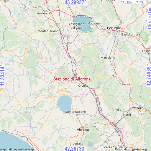
Stazione di Allerona GPS coordinates[2]
42° 47' 7.8" North, 12° 2' 14.136" East
| Map corner | latitude | longitude |
|---|---|---|
| Upper-left | 43.29937°, | 11.33414° |
| Center: | 42.7855°, | 12.03726° |
| Lower-right: | 42.26733°, | 12.74039° |
| Map W x H: | 114.8×114.8 km | = 71.3×71.3mi |
| max Lat: | 47.04031° ⇑64.7% North |
| Stazione di Allerona: | 42.7855° |
| min Lat: | ⇓35.3% South 35.50142° |
| min Long | Stazione di All | max Long |
| 6.69888° | 12.03726° | 18.48682° |
| W 56.4%⇐ | ⇒43.6% E |
Elevation
Elevation of Stazione di Allerona is 189 m = 620 ft, and this is 117.7 m = 386 ft below average elevation for this country.
| Max E: |
2085 m = 6841 ft | 56.8% |
| Avg. | 306.7 m = 1006 ft | |
| Stazione di Allerona | 189 m = 620 ft | |
Min E: |
-4 m = -13 ft | 43.2% |
See also: Italy elevation on elevation.city.
Geographical zone
Stazione di Allerona is located in North temperate zone (between Tropic of Cancer and the Arctic Circle). Distance of this Northern Tropic circle is 2151.4 km =1336.8 mi to South.| Distance of | km | miles | from Stazione di Allerona |
|---|---|---|---|
| North Pole | 5249.8 | 3262.1 | to North |
| Arctic Circle | 2643.9 | 1642.8 | to North |
| Tropic Cancer | 2151.4 | 1336.8 | to South |
| Equator | 4757.3 | 2956 | to South |


Nearby cities:
15 places around Stazione di Allerona: (largest is in red/bold)
• Allerona
5.9 km =3.7 mi,  299°
299°
• Castel Giorgio
10 km =6.2 mi,  209°
209°
• Castel Viscardo
4.6 km =2.9 mi,  220°
220°
• Ciconia
9.8 km =6.1 mi,  126°
126°
• Fabro
9.9 km =6.2 mi,  349°
349°
• Fabro Scalo
10.1 km =6.3 mi,  4°
4°
• Ficulle
5.7 km =3.5 mi,  25°
25°
• Monterubiaglio
2.7 km =1.7 mi, 218°
• Orvieto
9.6 km =6 mi,  140°
140°
• Orvieto Scalo
10.7 km =6.6 mi, 132°
• Parrano
10.8 km =6.7 mi, 33°
• Pianlungo
0.4 km =0.2 mi,  197°
197°
• Porano
12.8 km =8 mi,  155°
155°
• Santa Maria
11.9 km =7.4 mi, 0°
• Sferracavallo
8.1 km =5 mi, 144°
Sources, notices
• [Note1] Compared only with cities in Italy existing in our database
• [Src1] Map data: © OpenStreetMap contributors (CC-BY-SA)
• [Src2] Other city data from geonames.org with taken over terms of usage.
• [Src3] Geographical zone / Annual Mean Temperature by Robert A. Rohde @ Wikipedia
