Garofano geodata
Garofano (Emilia-Romagna) is a populated place; located in Italy in Europe/Rome (GMT+2) time zone. With population of 904 people, there are 7124 cities with bigger population in this country. Compared to other cities in Italy, 50.4% of cities are located further ↓South; 57.4% of cities are located further →East and 63.9% of cities have higher elevation than Garofano. Note1
Administrative division(s):
- Level 1: Emilia-Romagna
- Level 2: Provincia di Modena
- Level 3: Savignano sul Panaro


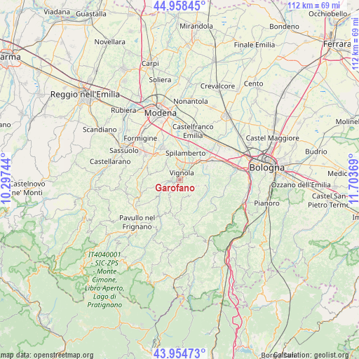
Garofano GPS coordinates[2]
44° 27' 31.5" North, 11° 0' 2.016" East
| Map corner | latitude | longitude |
|---|---|---|
| Upper-left | 44.95845°, | 10.29744° |
| Center: | 44.45875°, | 11.00056° |
| Lower-right: | 43.95473°, | 11.70369° |
| Map W x H: | 111.6×111.6 km | = 69.3×69.3mi |
| max Lat: | 47.04031° ⇑49.6% North |
| Garofano: | 44.45875° |
| min Lat: | ⇓50.4% South 35.50142° |
| min Long | Garofano | max Long |
| 6.69888° | 11.00056° | 18.48682° |
| W 42.6%⇐ | ⇒57.4% E |
Elevation
Elevation of Garofano is 135 m = 443 ft, and this is 171.7 m = 563 ft below average elevation for this country.
| Max E: |
2085 m = 6841 ft | 63.9% |
| Avg. | 306.7 m = 1006 ft | |
| Garofano | 135 m = 443 ft | |
Min E: |
-4 m = -13 ft | 36.1% |
See also: Italy elevation on elevation.city.
Geographical zone
Garofano is located in North temperate zone (between Tropic of Cancer and the Arctic Circle). Distance of this Northern Tropic circle is 2337.4 km =1452.4 mi to South.| Distance of | km | miles | from Garofano |
|---|---|---|---|
| North Pole | 5063.7 | 3146.4 | to North |
| Arctic Circle | 2457.8 | 1527.2 | to North |
| Tropic Cancer | 2337.4 | 1452.4 | to South |
| Equator | 4943.3 | 3071.6 | to South |


Nearby cities:
15 places around Garofano: (largest is in red/bold)
• Bazzano
8.3 km =5.2 mi,  55°
55°
• Ca' di Sola
8.7 km =5.4 mi,  335°
335°
• Castelletto
5.5 km =3.4 mi,  112°
112°
• Castelvetro di Modena
6.6 km =4.1 mi,  319°
319°
• Formica
1.5 km =0.9 mi,  43°
43°
• Guiglia
4.9 km =3 mi,  219°
219°
• Levizzano Rangone
7.8 km =4.8 mi,  292°
292°
• Marano sul Panaro
2.5 km =1.6 mi,  271°
271°
• Monteombraro
8.4 km =5.2 mi,  180°
180°
• Mulino
5.2 km =3.2 mi, 44°
• Rocca Malatina
8.3 km =5.2 mi,  200°
200°
• Savignano sul Panaro
3.6 km =2.2 mi,  48°
48°
• Spilamberto
8.3 km =5.2 mi,  8°
8°
• Stiore
9.4 km =5.8 mi,  79°
79°
• Vignola
2.9 km =1.8 mi,  16°
16°
Sources, notices
• [Note1] Compared only with cities in Italy existing in our database
• [Src1] Map data: © OpenStreetMap contributors (CC-BY-SA)
• [Src2] Other city data from geonames.org with taken over terms of usage.
• [Src3] Geographical zone / Annual Mean Temperature by Robert A. Rohde @ Wikipedia
