Roman catholic diocese of Terni geodata
Roman catholic diocese of Terni (Umbria) is a seat of a second-order administrative division; located in Italy in Europe/Rome (GMT+2) time zone. In our database, there are 11707 cities with bigger population. Compared to other cities in Italy, 65.9% of cities are located further ↑North; 64.1% of cities are located further ←West and 60% of cities have higher elevation than Roman catholic diocese of Terni. Note1
Current local time in Roman catholic diocese of Terni:
08:29 PM, ThursdayDifference from your time zone: hours


Roman catholic diocese of Terni GPS coordinates[2]
42° 33' 38.556" North, 12° 38' 35.196" East
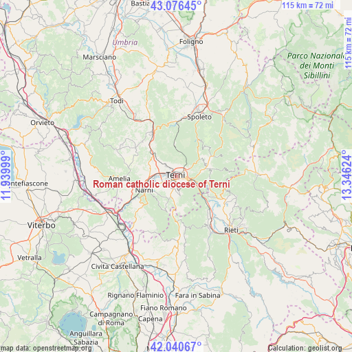
| Map corner | latitude | longitude |
|---|---|---|
| Upper-left | 43.07645°, | 11.93999° |
| Center: | 42.56071°, | 12.64311° |
| Lower-right: | 42.04067°, | 13.34624° |
| Map W x H: | 115.2×115.2 km | = 71.6×71.6mi |
| max Lat: | 47.04031° ⇑65.9% North |
| Roman catholic diocese of Terni: | 42.56071° |
| min Lat: | ⇓34.1% South 35.50142° |
| min Long | Roman catholic | max Long |
| 6.69888° | 12.64311° | 18.48682° |
| W 64.1%⇐ | ⇒35.9% E |
Elevation
Elevation of Roman catholic diocese of Terni is 163 m = 535 ft, and this is 143.7 m = 471 ft below average elevation for this country.
| Max E: |
2085 m = 6841 ft | 60% |
| Avg. | 306.7 m = 1006 ft | |
| Roman catholic diocese of Terni | 163 m = 535 ft | |
Min E: |
-4 m = -13 ft | 40% |
See also: Italy elevation on elevation.city.
Geographical zone
Roman catholic diocese of Terni is located in North temperate zone (between Tropic of Cancer and the Arctic Circle). Distance of this Northern Tropic circle is 2126.4 km =1321.3 mi to South.| Distance of | km | miles | from Roman catholic diocese of Terni |
|---|---|---|---|
| North Pole | 5274.8 | 3277.6 | to North |
| Arctic Circle | 2668.9 | 1658.4 | to North |
| Tropic Cancer | 2126.4 | 1321.3 | to South |
| Equator | 4732.3 | 2940.5 | to South |


Nearby cities:
15 places around Roman catholic diocese of Terni: (largest is in red/bold)
• Arrone
10.4 km =6.5 mi,  76°
76°
• Cesi
7.3 km =4.5 mi,  319°
319°
• Colli sul Velino
13.3 km =8.3 mi,  121°
121°
• Configni
15 km =9.3 mi,  179°
179°
• Ferentillo
13.5 km =8.4 mi,  60°
60°
• Labro
13.5 km =8.4 mi,  106°
106°
• Marmore
6 km =3.7 mi,  103°
103°
• Montefranco
10.7 km =6.6 mi,  67°
67°
• Narni
10.5 km =6.5 mi,  244°
244°
• Narni Scalo
10.7 km =6.6 mi,  255°
255°
• Ponte San Lorenzo
5.9 km =3.7 mi, 241°
• San Gemini
9.9 km =6.2 mi,  306°
306°
• Stroncone
5.4 km =3.4 mi, 176°
• Terni
0.3 km =0.2 mi,  2°
2°
• Testaccio
12.2 km =7.6 mi,  234°
234°
Sources, notices
• [Note1] Compared only with cities in Italy existing in our database
• [Src1] Map data: © OpenStreetMap contributors (CC-BY-SA)
• [Src2] Other city data from geonames.org with taken over terms of usage.
• [Src3] Geographical zone / Annual Mean Temperature by Robert A. Rohde @ Wikipedia
