Balīlā geodata
Balīlā (Jerash) is a populated place; located in Jordan in Asia/Amman (GMT+3) time zone. With population of 5,206 people, there are 65 cities with bigger population in this country. Compared to other cities in Jordan, 72.5% of cities are located further ↓South; 71.7% of cities are located further ←West and 60.1% of cities have lower elevation than Balīlā. Note1


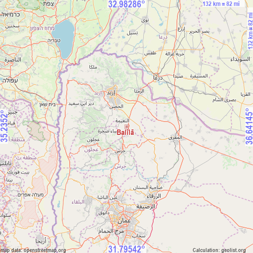
Balīlā GPS coordinates[2]
32° 23' 27.924" North, 35° 56' 17.952" East
| Map corner | latitude | longitude |
|---|---|---|
| Upper-left | 32.98286°, | 35.2352° |
| Center: | 32.39109°, | 35.93832° |
| Lower-right: | 31.79542°, | 36.64145° |
| Map W x H: | 132×132 km | = 82×82mi |
| max Lat: | 33.31405° ⇑27.5% North |
| Balīlā: | 32.39109° |
| min Lat: | ⇓72.5% South 29.40842° |
| min Long | Balīlā | max Long |
| 34.97918° | 35.93832° | 38.70342° |
| W 71.7%⇐ | ⇒28.3% E |
Elevation
Elevation of Balīlā is 796 m = 2612 ft, and this is 110.3 m = 362 ft above average elevation for this country.
| Max E: |
1440 m = 4724 ft | 39.9% |
| Balīlā | 796 m 2612 ft | |
| Avg. | 685.7 m = 2250 ft | |
Min E: |
-366 m = -1201 ft | 60.1% |
See also: Jordan elevation on elevation.city.
Geographical zone
Balīlā is located in North temperate zone (between Tropic of Cancer and the Arctic Circle). Distance of this Northern Tropic circle is 995.6 km =618.6 mi to South.| Distance of | km | miles | from Balīlā |
|---|---|---|---|
| North Pole | 6405.5 | 3980.2 | to North |
| Arctic Circle | 3799.6 | 2361 | to North |
| Tropic Cancer | 995.6 | 618.6 | to South |
| Equator | 3601.6 | 2237.9 | to South |


Nearby cities:
15 places around Balīlā: (largest is in red/bold)
• Al Kittah
15.6 km =9.7 mi,  215°
215°
• Al Mazār ash Shamālī
15.9 km =9.9 mi,  303°
303°
• Al Ḩişn
11.6 km =7.2 mi,  333°
333°
• Aydūn
14.8 km =9.2 mi, 329°
• Dayr Yūsuf
17.1 km =10.6 mi,  308°
308°
• Jarash
12.8 km =8 mi,  196°
196°
• Kitim
6.5 km =4 mi,  323°
323°
• Manshīyat Banī Ḩasan
13.4 km =8.3 mi,  99°
99°
• Qafqafā
4.7 km =2.9 mi,  179°
179°
• Raymūn
16 km =9.9 mi, 220°
• Rehab
16.2 km =10.1 mi,  117°
117°
• Sakib
17 km =10.6 mi,  225°
225°
• Sūf
12.8 km =8 mi, 227°
• Şakhrah
9.3 km =5.8 mi,  255°
255°
• Ḩawshā
16.5 km =10.3 mi,  66°
66°
Sources, notices
• [Note1] Compared only with cities in Jordan existing in our database
• [Src1] Map data: © OpenStreetMap contributors (CC-BY-SA)
• [Src2] Other city data from geonames.org with taken over terms of usage.
• [Src3] Geographical zone / Annual Mean Temperature by Robert A. Rohde @ Wikipedia
