Bal‘amā geodata
Bal‘amā (Mafraq) is a seat of a third-order administrative division; located in Jordan in Asia/Amman (GMT+3) time zone. In our database, there are 84 cities with bigger population. Compared to other cities in Jordan, 55.8% of cities are located further ↓South; 84.8% of cities are located further ←West and 58% of cities have higher elevation than Bal‘amā. Note1


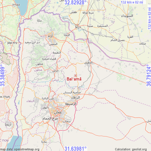
Bal‘amā GPS coordinates[2]
32° 14' 11.364" North, 36° 5' 17.196" East
| Map corner | latitude | longitude |
|---|---|---|
| Upper-left | 32.82928°, | 35.38499° |
| Center: | 32.23649°, | 36.08811° |
| Lower-right: | 31.63981°, | 36.79124° |
| Map W x H: | 132.3×132.3 km | = 82.2×82.2mi |
| max Lat: | 33.31405° ⇑44.2% North |
| Bal‘amā: | 32.23649° |
| min Lat: | ⇓55.8% South 29.40842° |
| min Long | Bal‘amā | max Long |
| 34.97918° | 36.08811° | 38.70342° |
| W 84.8%⇐ | ⇒15.2% E |
Elevation
Elevation of Bal‘amā is 673 m = 2208 ft, and this is 12.7 m = 42 ft below average elevation for this country.
| Max E: |
1440 m = 4724 ft | 58% |
| Avg. | 685.7 m = 2250 ft | |
| Bal‘amā | 673 m = 2208 ft | |
Min E: |
-366 m = -1201 ft | 42% |
See also: Jordan elevation on elevation.city.
Geographical zone
Bal‘amā is located in North temperate zone (between Tropic of Cancer and the Arctic Circle). Distance of this Northern Tropic circle is 978.4 km =607.9 mi to South.| Distance of | km | miles | from Bal‘amā |
|---|---|---|---|
| North Pole | 6422.7 | 3990.9 | to North |
| Arctic Circle | 3816.8 | 2371.6 | to North |
| Tropic Cancer | 978.4 | 607.9 | to South |
| Equator | 3584.4 | 2227.2 | to South |


Nearby cities:
15 places around Bal‘amā: (largest is in red/bold)
• Al Hāshimīyah
12.4 km =7.7 mi,  165°
165°
• Al Khālidīyah
21.2 km =13.2 mi,  107°
107°
• Al Kittah
23.7 km =14.7 mi,  280°
280°
• Al Maşţabah
22.6 km =14 mi,  255°
255°
• Al Ḩamrā’
23.4 km =14.5 mi,  14°
14°
• Az̧ Z̧ulayl
22.2 km =13.8 mi,  125°
125°
• Balīlā
22.2 km =13.8 mi,  320°
320°
• Bīrayn
19.6 km =12.2 mi,  218°
218°
• Jarash
18.4 km =11.4 mi,  285°
285°
• Mafraq
16.3 km =10.1 mi,  43°
43°
• Manshīyat Banī Ḩasan
14.9 km =9.3 mi,  356°
356°
• Muthallath Jāmi‘at Āl al Bayt
18.3 km =11.4 mi,  48°
48°
• Qafqafā
18.8 km =11.7 mi,  311°
311°
• Rehab
9.7 km =6 mi,  1°
1°
• Zarqa
18.2 km =11.3 mi,  180°
180°
Sources, notices
• [Note1] Compared only with cities in Jordan existing in our database
• [Src1] Map data: © OpenStreetMap contributors (CC-BY-SA)
• [Src2] Other city data from geonames.org with taken over terms of usage.
• [Src3] Geographical zone / Annual Mean Temperature by Robert A. Rohde @ Wikipedia
