Chichibu geodata
Chichibu (Saitama) is a seat of a second-order administrative division; located in Japan in Asia/Tokyo (GMT+9) time zone. With population of 58,507 people, there are 332 cities with bigger population in this country. Compared to other cities in Japan, 67.3% of cities are located further ↓South; 61.6% of cities are located further ←West and 90.6% of cities have lower elevation than Chichibu. Note1


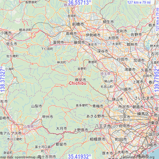
Chichibu GPS coordinates[2]
35° 59' 25.008" North, 139° 4' 35.004" East
| Map corner | latitude | longitude |
|---|---|---|
| Upper-left | 36.55713°, | 138.37327° |
| Center: | 35.99028°, | 139.07639° |
| Lower-right: | 35.41932°, | 139.77952° |
| Map W x H: | 126.5×126.5 km | = 78.6×78.6mi |
| max Lat: | 45.40944° ⇑32.7% North |
| Chichibu: | 35.99028° |
| min Lat: | ⇓67.3% South 24.34478° |
| min Long | Chichibu | max Long |
| 123° | 139.07639° | 145.575° |
| W 61.6%⇐ | ⇒38.4% E |
Elevation
Elevation of Chichibu is 236 m = 774 ft, and this is 151.4 m = 497 ft above average elevation for this country.
| Max E: |
1086 m = 3563 ft | 9.4% |
| Chichibu | 236 m 774 ft | |
| Avg. | 84.6 m = 278 ft | |
Min E: |
-2 m = -7 ft | 90.6% |
See also: Chichibu elevation on elevation.city.
Geographical zone
Chichibu is located in North temperate zone (between Tropic of Cancer and the Arctic Circle). Distance of this Northern Tropic circle is 1395.8 km =867.3 mi to South.| Distance of | km | miles | from Chichibu |
|---|---|---|---|
| North Pole | 6005.3 | 3731.5 | to North |
| Arctic Circle | 3399.4 | 2112.3 | to North |
| Tropic Cancer | 1395.8 | 867.3 | to South |
| Equator | 4001.7 | 2486.5 | to South |


Nearby cities:
15 places around Chichibu: (largest is in red/bold)
• Fujioka
28.5 km =17.7 mi,  359°
359°
• Fukaya
26.5 km =16.5 mi,  38°
38°
• Fukayachō
29.8 km =18.5 mi, 38°
• Hannō
26.6 km =16.5 mi,  125°
125°
• Hidaka
27 km =16.8 mi,  107°
107°
• Higashi-Matsuyama
31 km =19.3 mi,  81°
81°
• Honjō
29.4 km =18.3 mi,  20°
20°
• Kodamachō-kodamaminami
22.2 km =13.8 mi,  12°
12°
• Morohongō
21.4 km =13.3 mi, 106°
• Ogawa
18.5 km =11.5 mi,  67°
67°
• Sakado
28.4 km =17.6 mi,  97°
97°
• Tsurugashima
29.6 km =18.4 mi, 96°
• Yorii
17.5 km =10.9 mi, 37°
• Yoshii
30.1 km =18.7 mi,  343°
343°
• Ōme
27.4 km =17 mi,  146°
146°
Sources, notices
• [Note1] Compared only with cities in Japan existing in our database
• [Src1] Map data: © OpenStreetMap contributors (CC-BY-SA)
• [Src2] Other city data from geonames.org with taken over terms of usage.
• [Src3] Geographical zone / Annual Mean Temperature by Robert A. Rohde @ Wikipedia
