Kodamachō-kodamaminami geodata
Kodamachō-kodamaminami (Saitama) is a populated place; located in Japan in Asia/Tokyo (GMT+9) time zone. With population of 21,544 people, there are 672 cities with bigger population in this country. Compared to other cities in Japan, 71.4% of cities are located further ↓South; 62.4% of cities are located further ←West and 77.5% of cities have lower elevation than Kodamachō-kodamaminami. Note1
Current local time in Kodamachō-kodamaminami:
02:48 AM, ThursdayDifference from your time zone: hours


Kodamachō-kodamaminami GPS coordinates[2]
36° 11' 5.892" North, 139° 7' 54.876" East
| Map corner | latitude | longitude |
|---|---|---|
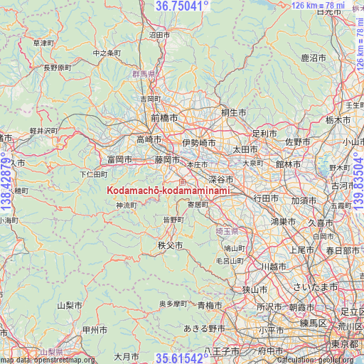
| Upper-left | 36.75041°, | 138.42879° |
| Center: | 36.18497°, | 139.13191° |
| Lower-right: | 35.61542°, | 139.83504° |
| Map W x H: | 126.2×126.2 km | = 78.4×78.4mi |
| max Lat: | 45.40944° ⇑28.6% North |
| Kodamachō-kodamaminami: | 36.18497° |
| min Lat: | ⇓71.4% South 24.34478° |
| min Long | Kodamachō-koda | max Long |
| 123° | 139.13191° | 145.575° |
| W 62.4%⇐ | ⇒37.6% E |
Elevation
Elevation of Kodamachō-kodamaminami is 106 m = 348 ft, and this is 21.4 m = 70 ft above average elevation for this country.
| Max E: |
1086 m = 3563 ft | 22.5% |
| Kodamachō-kodamaminami | 106 m 348 ft | |
| Avg. | 84.6 m = 278 ft | |
Min E: |
-2 m = -7 ft | 77.5% |
See also: Japan elevation on elevation.city.
Geographical zone
Kodamachō-kodamaminami is located in North temperate zone (between Tropic of Cancer and the Arctic Circle). Distance of this Northern Tropic circle is 1417.5 km =880.8 mi to South.| Distance of | km | miles | from Kodamachō-kodamaminami |
|---|---|---|---|
| North Pole | 5983.7 | 3718.1 | to North |
| Arctic Circle | 3377.8 | 2098.9 | to North |
| Tropic Cancer | 1417.5 | 880.8 | to South |
| Equator | 4023.4 | 2500 | to South |


Nearby cities:
15 places around Kodamachō-kodamaminami: (largest is in red/bold)
• Chichibu
22.2 km =13.8 mi,  192°
192°
• Fujioka
8.7 km =5.4 mi,  321°
321°
• Fukaya
11.6 km =7.2 mi,  94°
94°
• Fukayachō
13.7 km =8.5 mi,  82°
82°
• Honjō
7.9 km =4.9 mi,  41°
41°
• Isesaki
15.9 km =9.9 mi,  22°
22°
• Kumagaya
23.8 km =14.8 mi,  103°
103°
• Menuma
22.8 km =14.2 mi, 79°
• Ogawa
19 km =11.8 mi,  140°
140°
• Sakai-nakajima
14 km =8.7 mi,  49°
49°
• Takasaki
19.5 km =12.1 mi,  327°
327°
• Tamamura
12.9 km =8 mi,  353°
353°
• Tomioka
22.3 km =13.9 mi,  290°
290°
• Yorii
9.5 km =5.9 mi, 143°
• Yoshii
15.2 km =9.4 mi,  298°
298°
Sources, notices
• [Note1] Compared only with cities in Japan existing in our database
• [Src1] Map data: © OpenStreetMap contributors (CC-BY-SA)
• [Src2] Other city data from geonames.org with taken over terms of usage.
• [Src3] Geographical zone / Annual Mean Temperature by Robert A. Rohde @ Wikipedia
