Takanosu geodata
Takanosu (Akita) is a populated place; located in Japan in Asia/Tokyo (GMT+9) time zone. With population of 20,542 people, there are 684 cities with bigger population in this country. Compared to other cities in Japan, 93.8% of cities are located further ↓South; 84% of cities are located further ←West and 51.1% of cities have higher elevation than Takanosu. Note1


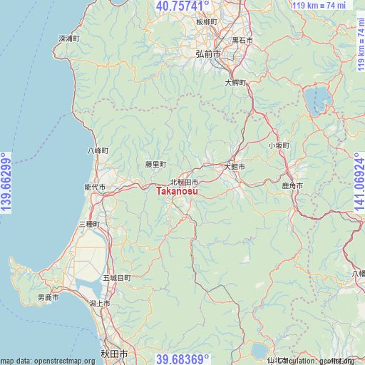
Takanosu GPS coordinates[2]
40° 13' 21.648" North, 140° 21' 57.996" East
| Map corner | latitude | longitude |
|---|---|---|
| Upper-left | 40.75741°, | 139.66299° |
| Center: | 40.22268°, | 140.36611° |
| Lower-right: | 39.68369°, | 141.06924° |
| Map W x H: | 119.4×119.4 km | = 74.2×74.2mi |
| max Lat: | 45.40944° ⇑6.2% North |
| Takanosu: | 40.22268° |
| min Lat: | ⇓93.8% South 24.34478° |
| min Long | Takanosu | max Long |
| 123° | 140.36611° | 145.575° |
| W 84%⇐ | ⇒16% E |
Elevation
Elevation of Takanosu is 27 m = 89 ft, and this is 57.6 m = 189 ft below average elevation for this country.
| Max E: |
1086 m = 3563 ft | 51.1% |
| Avg. | 84.6 m = 278 ft | |
| Takanosu | 27 m = 89 ft | |
Min E: |
-2 m = -7 ft | 48.9% |
See also: Japan elevation on elevation.city.
Geographical zone
Takanosu is located in North temperate zone (between Tropic of Cancer and the Arctic Circle). Distance of this Northern Tropic circle is 1866.4 km =1159.7 mi to South.| Distance of | km | miles | from Takanosu |
|---|---|---|---|
| North Pole | 5534.7 | 3439.1 | to North |
| Arctic Circle | 2928.8 | 1819.9 | to North |
| Tropic Cancer | 1866.4 | 1159.7 | to South |
| Equator | 4472.3 | 2779 | to South |


Nearby cities:
15 places around Takanosu: (largest is in red/bold)
• Akita
60.1 km =37.3 mi,  200°
200°
• Hanawa
36 km =22.4 mi,  96°
96°
• Hirakawa
44.1 km =27.4 mi,  23°
23°
• Hirosaki
42.2 km =26.2 mi,  12°
12°
• Katagami
49.5 km =30.8 mi,  219°
219°
• Kazuno
35.5 km =22.1 mi,  92°
92°
• Kita-Akita
3.5 km =2.2 mi,  137°
137°
• Kuroishi
50.5 km =31.4 mi, 21°
• Kuroishi
52.2 km =32.4 mi,  33°
33°
• Namioka
57.5 km =35.7 mi, 19°
• Noshiro
28.8 km =17.9 mi,  266°
266°
• Oga
58.9 km =36.6 mi,  228°
228°
• Tennō
49.4 km =30.7 mi, 223°
• Tsugaru
64.7 km =40.2 mi,  2°
2°
• Ōdate
17.1 km =10.6 mi,  71°
71°
Sources, notices
• [Note1] Compared only with cities in Japan existing in our database
• [Src1] Map data: © OpenStreetMap contributors (CC-BY-SA)
• [Src2] Other city data from geonames.org with taken over terms of usage.
• [Src3] Geographical zone / Annual Mean Temperature by Robert A. Rohde @ Wikipedia
