Tsugaru geodata
Tsugaru (Aomori) is a seat of a second-order administrative division; located in Japan in Asia/Tokyo (GMT+9) time zone. In our database, there are 767 cities with bigger population. Compared to other cities in Japan, 95% of cities are located further ↓South; 85.3% of cities are located further ←West and 86% of cities have higher elevation than Tsugaru. Note1


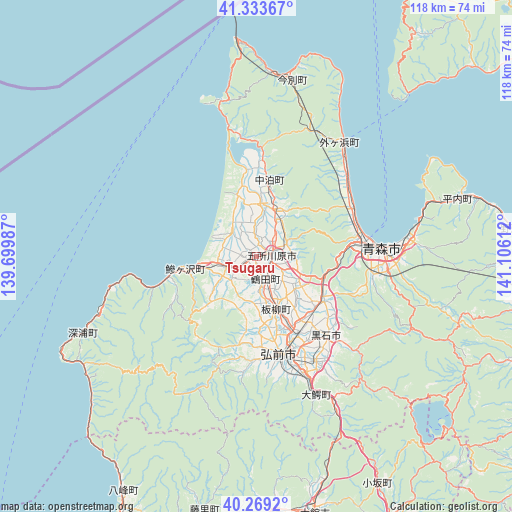
Tsugaru GPS coordinates[2]
40° 48' 12.852" North, 140° 24' 10.764" East
| Map corner | latitude | longitude |
|---|---|---|
| Upper-left | 41.33367°, | 139.69987° |
| Center: | 40.80357°, | 140.40299° |
| Lower-right: | 40.2692°, | 141.10612° |
| Map W x H: | 118.4×118.4 km | = 73.6×73.6mi |
| max Lat: | 45.40944° ⇑5% North |
| Tsugaru: | 40.80357° |
| min Lat: | ⇓95% South 24.34478° |
| min Long | Tsugaru | max Long |
| 123° | 140.40299° | 145.575° |
| W 85.3%⇐ | ⇒14.7% E |
Elevation
Elevation of Tsugaru is 6 m = 20 ft, and this is 78.6 m = 258 ft below average elevation for this country.
| Max E: |
1086 m = 3563 ft | 86% |
| Avg. | 84.6 m = 278 ft | |
| Tsugaru | 6 m = 20 ft | |
Min E: |
-2 m = -7 ft | 14% |
See also: Japan elevation on elevation.city.
Geographical zone
Tsugaru is located in North temperate zone (between Tropic of Cancer and the Arctic Circle). Distance of this Northern Tropic circle is 1931 km =1199.9 mi to South.| Distance of | km | miles | from Tsugaru |
|---|---|---|---|
| North Pole | 5470.1 | 3399 | to North |
| Arctic Circle | 2864.2 | 1779.7 | to North |
| Tropic Cancer | 1931 | 1199.9 | to South |
| Equator | 4536.9 | 2819.1 | to South |


Nearby cities:
15 places around Tsugaru: (largest is in red/bold)
• Aomori
27.8 km =17.3 mi,  87°
87°
• Goshogawara
3.2 km =2 mi, 88°
• Hanawa
76.2 km =47.3 mi,  154°
154°
• Hirakawa
27.9 km =17.3 mi, 149°
• Hirosaki
24.1 km =15 mi,  165°
165°
• Kazuno
73.6 km =45.7 mi, 154°
• Kita-Akita
67.2 km =41.8 mi,  180°
180°
• Kuroishi
23.2 km =14.4 mi,  139°
139°
• Kuroishi
32.9 km =20.4 mi,  129°
129°
• Namioka
18.9 km =11.7 mi,  123°
123°
• Noshiro
73.4 km =45.6 mi,  205°
205°
• Shimokizukuri
2.7 km =1.7 mi,  300°
300°
• Takanosu
64.7 km =40.2 mi, 182°
• Towada
71.1 km =44.2 mi,  106°
106°
• Ōdate
60.6 km =37.7 mi, 167°
Sources, notices
• [Note1] Compared only with cities in Japan existing in our database
• [Src1] Map data: © OpenStreetMap contributors (CC-BY-SA)
• [Src2] Other city data from geonames.org with taken over terms of usage.
• [Src3] Geographical zone / Annual Mean Temperature by Robert A. Rohde @ Wikipedia
