Nayoro geodata
Nayoro (Hokkaido) is a seat of a second-order administrative division; located in Japan in Asia/Tokyo (GMT+9) time zone. With population of 26,457 people, there are 586 cities with bigger population in this country. Compared to other cities in Japan, 99.6% of cities are located further ↓South; 99% of cities are located further ←West and 75.3% of cities have lower elevation than Nayoro. Note1


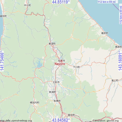
Nayoro GPS coordinates[2]
44° 21' 2.016" North, 142° 27' 28.008" East
| Map corner | latitude | longitude |
|---|---|---|
| Upper-left | 44.85119°, | 141.75466° |
| Center: | 44.35056°, | 142.45778° |
| Lower-right: | 43.84562°, | 143.16091° |
| Map W x H: | 111.8×111.8 km | = 69.5×69.5mi |
| max Lat: | 45.40944° ⇑0.4% North |
| Nayoro: | 44.35056° |
| min Lat: | ⇓99.6% South 24.34478° |
| min Long | Nayoro | max Long |
| 123° | 142.45778° | 145.575° |
| W 99%⇐ | ⇒1% E |
Elevation
Elevation of Nayoro is 97 m = 318 ft, and this is 12.4 m = 41 ft above average elevation for this country.
| Max E: |
1086 m = 3563 ft | 24.7% |
| Nayoro | 97 m 318 ft | |
| Avg. | 84.6 m = 278 ft | |
Min E: |
-2 m = -7 ft | 75.3% |
See also: Japan elevation on elevation.city.
Geographical zone
Nayoro is located in North temperate zone (between Tropic of Cancer and the Arctic Circle). Distance of this Northern Tropic circle is 2325.4 km =1444.9 mi to South.| Distance of | km | miles | from Nayoro |
|---|---|---|---|
| North Pole | 5075.7 | 3153.9 | to North |
| Arctic Circle | 2469.9 | 1534.7 | to North |
| Tropic Cancer | 2325.4 | 1444.9 | to South |
| Equator | 4931.3 | 3064.2 | to South |


Nearby cities:
15 places around Nayoro: (largest is in red/bold)
• Akabira
94.6 km =58.8 mi,  200°
200°
• Asahikawa
64.9 km =40.3 mi,  186°
186°
• Ashibetsu
96 km =59.7 mi, 193°
• Bibai
123.8 km =76.9 mi, 202°
• Fukagawa
78.9 km =49 mi,  205°
205°
• Furano
111.4 km =69.2 mi,  183°
183°
• Kamikawa
62 km =38.5 mi,  156°
156°
• Mobetsu
72.3 km =44.9 mi,  97°
97°
• Mombetsu
71.1 km =44.2 mi,  89°
89°
• Rumoi
79.8 km =49.6 mi,  234°
234°
• Shibetsu
20.5 km =12.7 mi, 194°
• Shimo-furano
111.4 km =69.2 mi, 183°
• Sunagawa
105.8 km =65.7 mi, 204°
• Takikawa
99.1 km =61.6 mi, 206°
• Utashinai
98.3 km =61.1 mi, 199°
Sources, notices
• [Note1] Compared only with cities in Japan existing in our database
• [Src1] Map data: © OpenStreetMap contributors (CC-BY-SA)
• [Src2] Other city data from geonames.org with taken over terms of usage.
• [Src3] Geographical zone / Annual Mean Temperature by Robert A. Rohde @ Wikipedia
