Kawachi-Nagano geodata
Kawachi-Nagano (Ōsaka) is a seat of a second-order administrative division; located in Japan in Asia/Tokyo (GMT+9) time zone. In our database, there are 767 cities with bigger population. Compared to other cities in Japan, 73.8% of cities are located further ↑North; 66.1% of cities are located further →East and 87.9% of cities have lower elevation than Kawachi-Nagano. Note1


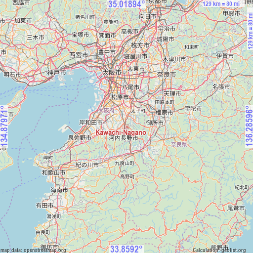
Kawachi-Nagano GPS coordinates[2]
34° 26' 27.888" North, 135° 34' 58.188" East
| Map corner | latitude | longitude |
|---|---|---|
| Upper-left | 35.01894°, | 134.87971° |
| Center: | 34.44108°, | 135.58283° |
| Lower-right: | 33.8592°, | 136.28596° |
| Map W x H: | 129×129 km | = 80.2×80.2mi |
| max Lat: | 45.40944° ⇑73.8% North |
| Kawachi-Nagano: | 34.44108° |
| min Lat: | ⇓26.2% South 24.34478° |
| min Long | Kawachi-Nagano | max Long |
| 123° | 135.58283° | 145.575° |
| W 33.9%⇐ | ⇒66.1% E |
Elevation
Elevation of Kawachi-Nagano is 197 m = 646 ft, and this is 112.4 m = 369 ft above average elevation for this country.
| Max E: |
1086 m = 3563 ft | 12.1% |
| Kawachi-Nagano | 197 m 646 ft | |
| Avg. | 84.6 m = 278 ft | |
Min E: |
-2 m = -7 ft | 87.9% |
See also: Japan elevation on elevation.city.
Geographical zone
Kawachi-Nagano is located in North temperate zone (between Tropic of Cancer and the Arctic Circle). Distance of this Northern Tropic circle is 1223.6 km =760.3 mi to South.| Distance of | km | miles | from Kawachi-Nagano |
|---|---|---|---|
| North Pole | 6177.6 | 3838.6 | to North |
| Arctic Circle | 3571.7 | 2219.4 | to North |
| Tropic Cancer | 1223.6 | 760.3 | to South |
| Equator | 3829.5 | 2379.5 | to South |


Nearby cities:
15 places around Kawachi-Nagano: (largest is in red/bold)
• Fujiidera
14.1 km =8.8 mi,  5°
5°
• Gojō
14.8 km =9.2 mi,  133°
133°
• Gose
13.8 km =8.6 mi,  85°
85°
• Habikino
12.4 km =7.7 mi,  3°
3°
• Hashimoto
14.2 km =8.8 mi,  167°
167°
• Izumi
14.5 km =9 mi,  288°
288°
• Izumiōtsu
18 km =11.2 mi, 291°
• Kashiba
15.6 km =9.7 mi,  48°
48°
• Kashihara
16.1 km =10 mi, 11°
• Katsuragi
11.6 km =7.2 mi,  64°
64°
• Matsubara
14.3 km =8.9 mi,  347°
347°
• Takaishi
16.1 km =10 mi,  301°
301°
• Tondabayashichō
6.9 km =4.3 mi, 14°
• Yamato-Takada
17.5 km =10.9 mi, 61°
• Ōsaka-sayama
6.7 km =4.2 mi,  333°
333°
Sources, notices
• [Note1] Compared only with cities in Japan existing in our database
• [Src1] Map data: © OpenStreetMap contributors (CC-BY-SA)
• [Src2] Other city data from geonames.org with taken over terms of usage.
• [Src3] Geographical zone / Annual Mean Temperature by Robert A. Rohde @ Wikipedia
