Shijōnawate geodata
Shijōnawate (Ōsaka) is a seat of a second-order administrative division; located in Japan in Asia/Tokyo (GMT+9) time zone. In our database, there are 767 cities with bigger population. Compared to other cities in Japan, 67.5% of cities are located further ↑North; 64.7% of cities are located further →East and 92.1% of cities have lower elevation than Shijōnawate. Note1


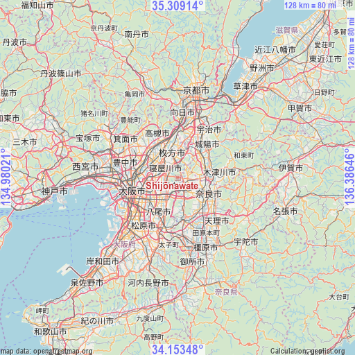
Shijōnawate GPS coordinates[2]
34° 43' 59.988" North, 135° 40' 59.988" East
| Map corner | latitude | longitude |
|---|---|---|
| Upper-left | 35.30914°, | 134.98021° |
| Center: | 34.73333°, | 135.68333° |
| Lower-right: | 34.15348°, | 136.38646° |
| Map W x H: | 128.5×128.5 km | = 79.8×79.8mi |
| max Lat: | 45.40944° ⇑67.5% North |
| Shijōnawate: | 34.73333° |
| min Lat: | ⇓32.5% South 24.34478° |
| min Long | Shijōnawate | max Long |
| 123° | 135.68333° | 145.575° |
| W 35.3%⇐ | ⇒64.7% E |
Elevation
Elevation of Shijōnawate is 268 m = 879 ft, and this is 183.4 m = 602 ft above average elevation for this country.
| Max E: |
1086 m = 3563 ft | 7.9% |
| Shijōnawate | 268 m 879 ft | |
| Avg. | 84.6 m = 278 ft | |
Min E: |
-2 m = -7 ft | 92.1% |
See also: Japan elevation on elevation.city.
Geographical zone
Shijōnawate is located in North temperate zone (between Tropic of Cancer and the Arctic Circle). Distance of this Northern Tropic circle is 1256.1 km =780.5 mi to South.| Distance of | km | miles | from Shijōnawate |
|---|---|---|---|
| North Pole | 6145.1 | 3818.4 | to North |
| Arctic Circle | 3539.2 | 2199.2 | to North |
| Tropic Cancer | 1256.1 | 780.5 | to South |
| Equator | 3862 | 2399.7 | to South |


Nearby cities:
15 places around Shijōnawate: (largest is in red/bold)
• Daitōchō
6.2 km =3.9 mi,  249°
249°
• Higashi-ōsaka
11.8 km =7.3 mi,  230°
230°
• Hirakata
9.4 km =5.8 mi,  340°
340°
• Ibaraki
14 km =8.7 mi,  311°
311°
• Ikoma
5.8 km =3.6 mi,  164°
164°
• Kadoma
10 km =6.2 mi,  273°
273°
• Katano
6.7 km =4.2 mi,  2°
2°
• Kizugawa
14.3 km =8.9 mi,  88°
88°
• Kyōtanabe
11 km =6.8 mi,  43°
43°
• Moriguchi
10.7 km =6.6 mi, 270°
• Nara-shi
12.3 km =7.6 mi,  115°
115°
• Neyagawa
6.3 km =3.9 mi, 305°
• Settsu
9.5 km =5.9 mi,  301°
301°
• Takatsuki
14.2 km =8.8 mi,  334°
334°
• Tanabe
12.5 km =7.8 mi, 37°
Sources, notices
• [Note1] Compared only with cities in Japan existing in our database
• [Src1] Map data: © OpenStreetMap contributors (CC-BY-SA)
• [Src2] Other city data from geonames.org with taken over terms of usage.
• [Src3] Geographical zone / Annual Mean Temperature by Robert A. Rohde @ Wikipedia
